| << Portugal: Amtliche topografische Landkarten des Instituto Geográfico do Exército (IGeoE) 1:25.000 (Serie M888) |
||
|
||

Zuletzt angesehene Artikel:
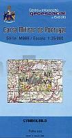
 | 104 - Topographische Landkarte Portugal 1:25.000 Carta Militar de Portugal - Série M888 Instituto Geográfico do Exército (IGeoE) - Portugal |
 | Hochsauerland, Winterberg, Kahler Asten und Umgebung - Wander-, Ski- und Radwanderkarte 1:30.000 (Nr. 234) Ausflüge zwischen Siedlinghausen, Küstelberg, Liesen, Medebach, Girkhausen und Hallenberg. MaÃstab 1:30000 Dr. Barthel Verlag |
 | 22 Noord-Brabant East - Limburg Norh bicycle junction maps Knotenpunkte-Fahrradkarte 1:100.000 Fietsknooppuntenkaart 22 ANWB - Niederlande |
 | 469-3 ALCAÃIZ Amtliche topographische Landkarte 1:25.000 Spanien (M.T.N.) 469-3 Mapa Topográfico Nacional de Espana (MTN25) Instituto Geográfico Nacional - CNIG Spanien |
 | 4221 09 Viuruniemi Topographische Karte 1:20.000 (Maastokartta / Peruskartta / Grundkarta) Maanmittauslaitos / Lantmäteriverket Finnland - ProjektNord |
 | Markazi Tourist Map of Province (Bl. 226) 1:550.000 Landkarte Englisch und Persisch نقشه استان مركزي Gitashenasi - Iran |
 | 814-3 VILLANUEVA DE LA FUENTE Amtliche topographische Landkarte 1:25.000 Spanien (M.T.N.) 814-3 Mapa Topográfico Nacional de Espana (MTN25) Instituto Geográfico Nacional - CNIG Spanien |
 | 1049 (13-44) Arcos de la Frontera Amtliche topographische Landkarte 1:50.000 Spanien (M.T.N.) 1049 Mapa Topográfico Nacional de Espana (MTN50) Instituto Geográfico Nacional - CNIG Spanien |
 | 127 Tabuaco - Topographische Landkarte Portugal 1:25.000 Carta Militar de Portugal - Série M888 Instituto Geográfico do Exército (IGeoE) - Portugal |
 | 514-1 LEBRANCÃN Amtliche topographische Landkarte 1:25.000 Spanien (M.T.N.) 514-1 Mapa Topográfico Nacional de Espana (MTN25) Instituto Geográfico Nacional - CNIG Spanien |
 | 310 Tomar - Topographische Landkarte Portugal 1:25.000 Carta Militar de Portugal - Série M888 Instituto Geográfico do Exército (IGeoE) - Portugal |
 | 36-1 SANTOÃA Amtliche topographische Landkarte 1:25.000 Spanien (M.T.N.) 36-1 Mapa Topográfico Nacional de Espana (MTN25) Instituto Geográfico Nacional - CNIG Spanien |
 | 441-3 HÃJAR Amtliche topographische Landkarte 1:25.000 Spanien (M.T.N.) 441-3 Mapa Topográfico Nacional de Espana (MTN25) Instituto Geográfico Nacional - CNIG Spanien |
 | 632 Horcajo de Santiago Amtliche topographische Landkarte 1:50.000 Spanien (M.T.N.) 632 Mapa Topográfico Nacional de Espana (MTN50) Instituto Geográfico Nacional - CNIG Spanien |
 | 36 Trollhättan 1:50.000 (wasserfest) *** SCHNÃPPCHEN *** Topographische Wanderkarte - Sverigeserien Topo50 - Schweden Norstedts |
 | 246 Fundao - Topographische Landkarte Portugal 1:25.000 Carta Militar de Portugal - Série M888 Instituto Geográfico do Exército (IGeoE) - Portugal |
 | 248-A - Topographische Landkarte Portugal 1:25.000 Carta Militar de Portugal - Série M888 Instituto Geográfico do Exército (IGeoE) - Portugal |
 | 919-1 EL REAL DE LA JARA Amtliche topographische Landkarte 1:25.000 Spanien (M.T.N.) 919-1 Mapa Topográfico Nacional de Espana (MTN25) Instituto Geográfico Nacional - CNIG Spanien |
 | 1086-IV (Fuerteventura) La Oliva Amtliche topographische Landkarte 1:25.000 Spanien (M.T.N.) 1086-IV Mapa Topográfico Nacional de Espana (MTN25) Instituto Geográfico Nacional - CNIG Spanien |
 | Gibostad - Rystraumen - Hekkingen- Seekarte Norwegische Küste 1:50.000 - (Blatt 84) Den Norske Kyst Sjøkart - Hovedkart (sjø) Statens Kartverk Sjø - Norwegen |