| << Portugal: Amtliche topografische Landkarten des Instituto Geográfico do Exército (IGeoE) 1:25.000 (Serie M888) |
||
|
||

Zuletzt angesehene Artikel:
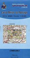
 | 57 - Topographische Landkarte Portugal 1:25.000 Carta Militar de Portugal - Série M888 Instituto Geográfico do Exército (IGeoE) - Portugal |
 | Giby (kopia) Topographische Karte 1:25.000 Messtischblatt des Deutschen Reiches - PreuÃische Landesaufnahme / Reichsamt für Landesaufnahme - Faksimile ProjektNord |
 | 3242 Königshorst Sonderausgabe mit Wanderwegen - Topographische Wanderkarte Brandenburg 1:25.000 ProjektNord |
| 322.32 Amtliche topographische Karte 1:25.000 Polen |
 | 5634 Teuschnitz Topographische Landkarte Bayern 1:25.000 - Normalausgabe - ProjektNord (geplottete Ausgabe) - Grundlage amtliche Topographische Karte Bayern DTK25 |
 | 7030 Wolferstadt Topographische Landkarte Bayern 1:25.000 - Normalausgabe - ProjektNord (geplottete Ausgabe) - Grundlage amtliche Topographische Karte Bayern DTK25 |
 | KUNTH EASY MAP Sylt 1:55.000 - von - Kunth Verlag |
 | Q5323 Mujejärvi Topographische Karte 1:25.000 EUREF (Peruskartta) Maanmittauslaitos / Lantmäteriverket Finnland - ProjektNord |
 | Jekaterinburg Stadtplan 1:20.000 Doroschnaja Karta Jekaterinburga - Uralskaja Kartografitscheskaja Kompanija - Russland |
 | 5834 Kulmbach Topographische Landkarte Bayern 1:25.000 - Normalausgabe - ProjektNord (geplottete Ausgabe) - Grundlage amtliche Topographische Karte Bayern DTK25 |
 | Durch Kleinpolen auf dem Fahrrad 1:100.000 (poln.) Radwanderkarte - Fahrradkarte Małopolska na rowerze - Velo Małopolska Compass - Polen |
 | 37O ROTTERDAM (Oost) Topographische Karte der Niederlande 1:50.000 Topografische Dienst (Plotausgabe) |
 | S5424 Särkiluoma Topographische Karte 1:25.000 EUREF (Peruskartta) Maanmittauslaitos / Lantmäteriverket Finnland - ProjektNord |
 | LA RUTA DE LES MIL ALCASSABES Kultur-Landkarte Süd-Marokko 1:400.000 (katalanische Ausgabe) - Editorial Editorial Piolet |
 | Nationalpark Kellerwald-Edersee - Naturpark Habichtswald - Wanderregion Medebach (Blatt 845) Wanderkarte Wanderkarte 1:50.000 - KOMPASS |
 | Provinz Luxemburg Süd (Belgien) - Knotenpunkte NGI 1:50.000 Fahrradkarte Belgien Réseaux Points-N?uds de la Province de Luxembourg carte Sud/ Fietsknooppuntennetwerk Provincie Luxemburg Kaart zuiden NGI Belgien |
 | Saar-Hunsrück-Steig 2, Idar-Oberstein - Boppard Leporello Wanderkarte mit Ausflugs-, Einkehr- und Freizeittipps, Entfernungen, Etappen und Höhenprofil sowie StraÃennamen, wetterfest, reiÃfest, abwischbar, GPS-genau. 1:25000 - von - Freytag-Berndt und ARTARIA Publicpress |
| 3861 Köbnitz Topographische Karte 1:25.000 Messtischblatt des Deutschen Reiches - PreuÃische Landesaufnahme / Reichsamt für Landesaufnahme - Faksimile ProjektNord |
 | 3453 Küstrin - Kietz Sonderausgabe mit Wanderwegen - Topographische Wanderkarte Brandenburg 1:25.000 ProjektNord |
 | MARCO POLO Regionalkarte Costa Brava / Pyrenäen / Baskenland / Navarra / Aragon / Andorra / Kantalonien Baskenland, Navarra, Aragon, Andorra, Kantalonien |