Willkommen bei MapFox
Wurde Ihre Bestellung bestätigt? Wenn nicht - gab es evtl. ein SERVER-Problem! Bitte kontaktieren Sie uns! +++ Buchhändler-Anfragen erwünscht +++
Warenkorb
Artikel: 0 - € 0.00
Zur Kasse
Impressum Kontakt Versandkosten AGB
40 Viana do Castelo - Topographische Landkarte Portugal 1:25.000 Carta Militar de Portugal - Série M888 Instituto Geográfico do Exército (IGeoE) - Portugal
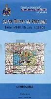
<< Portugal: Amtliche topografische Landkarten des Instituto Geográfico do Exército (IGeoE) 1:25.000 (Serie M888)
 
Cover

Gesamtliste mit Blattübersicht

Kartenausschnitt

Kartenbeispiel

40 Viana do Castelo - Topographische Landkarte Portugal 1:25.000 Carta Militar de Portugal - Série M888 Instituto Geográfico do Exército (IGeoE) - Portugal
EAN / ISBN: 9789727900220
Preis: EUR 17.90

Bestellartikel: versandfertig in ca. 2 Wochen oder länger. Dieser Artikel wird speziell für Sie bestellt. Keine Rücknahme!
Produkt EUR Anzahl Bestellen
40 Viana do Castelo - Topographische Landkarte Portugal 1:25.000 Carta Militar de Portugal - Série M888 Instituto Geográfico do Exército (IGeoE) - Portugal 17.90
Versandkostenfrei in Deutschland ab 30,- Bestellwert

incl. MwSt.

Stichworte, die bei der Suche nützlich sein könnten:
Viana do Castelo Landkarte - Viana do Castelo - Portugal - topografische Wanderkarten - Serie M888 - Série M888 - M888

Zuletzt angesehene Artikel:

Cover40 Viana do Castelo - Topographische Landkarte Portugal 1:25.000 Carta Militar de Portugal - Série M888 Instituto Geográfico do Exército (IGeoE) - Portugal

Cover4029 Vienenburg Amtliche topographische Karte 1:25.000 Landesvermessungsamt Niedersachsen

CoverVeloland Schweiz Bd.5 Mittelland-Route WerdVerlag

Cover362 Ramalhal (Torres Vedras) Topographische Landkarte Portugal 1:25.000 Carta Militar de Portugal - Série M888 Instituto Geográfico do Exército (IGeoE) - Portugal

CoverAlto Garda, Ledro, Valle del Sarca (Nr. 096) 1:25.000 Wanderkarte Wandern, Rad. GPS-genau. Wetterfest, reißfest - Kompass-Karten

CoverV4314 Topographische Karte 1:25.000 EUREF (Peruskartta) Maanmittauslaitos / Lantmäteriverket Finnland - ProjektNord

CoverV5134 Topographische Karte 1:25.000 EUREF (Peruskartta) Maanmittauslaitos / Lantmäteriverket Finnland - ProjektNord

CoverV4442 Topographische Karte 1:25.000 EUREF (Peruskartta) Maanmittauslaitos / Lantmäteriverket Finnland - ProjektNord

CoverQ4323 Venetpalo Topographische Karte 1:25.000 EUREF (Peruskartta) Maanmittauslaitos / Lantmäteriverket Finnland - ProjektNord

CoverV5142 Topographische Karte 1:25.000 EUREF (Peruskartta) Maanmittauslaitos / Lantmäteriverket Finnland - ProjektNord

CoverV5242 Topographische Karte 1:25.000 EUREF (Peruskartta) Maanmittauslaitos / Lantmäteriverket Finnland - ProjektNord

CoverVisé NGI 1:25.000 Touristische Wanderkarte und Mountainbikekarte Belgien NGI Belgien

CoverL3728 Braunschweig (geplottete Ausgabe) Topographische Karte 1:50.000 Kartografie Landesvermessungsamt Niedersachsen - ProjektNord

CoverL3314 Vechta (geplottete Ausgabe) Topographische Karte 1:50.000 Kartografie Landesvermessungsamt Niedersachsen - ProjektNord

CoverOblast Wologda Topographischer Regional-Atlas 1:200.000
Вологодская область FGUP- Aerogeodezija

CoverV5143 Topographische Karte 1:25.000 EUREF (Peruskartta) Maanmittauslaitos / Lantmäteriverket Finnland - ProjektNord

Cover6127 Volkach Topographische Landkarte Bayern 1:25.000 - Normalausgabe - ProjektNord (geplottete Ausgabe) - Grundlage amtliche Topographische Karte Bayern DTK25

CoverV5114 Topographische Karte 1:25.000 EUREF (Peruskartta) Maanmittauslaitos / Lantmäteriverket Finnland - ProjektNord

CoverQ4224 Vasankari Topographische Karte 1:25.000 EUREF (Peruskartta) Maanmittauslaitos / Lantmäteriverket Finnland - ProjektNord

CoverU4342 Vaalajärvi Topographische Karte 1:25.000 EUREF (Peruskartta) Maanmittauslaitos / Lantmäteriverket Finnland - ProjektNord