| << Portugal: Amtliche topografische Landkarten des Instituto Geográfico do Exército (IGeoE) 1:25.000 |
  | |
|
||
Zuletzt angesehene Artikel:
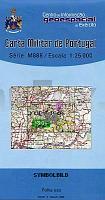
![]() | 34 - Topographische Landkarte Portugal 1:25.000 Carta Militar de Portugal - Série M889 Instituto Geográfico do Exército (IGeoE) - Portugal |
![]() | 332.2 Amtliche topographische Karte 1:50.000 Polen |
![]() | 323.41 Amtliche topographische Karte 1:25.000 Polen |
![]() | Recklinghausen Topographische Wanderkarte Nordrhein-Westfalen mit Wanderwegen und Radwegen 1:25.000 - ProjektNord |
![]() | 3959 Züllichau Topographische Karte 1:25.000 Messtischblatt des Deutschen Reiches - Preußische Landesaufnahme / Reichsamt für Landesaufnahme - Faksimile ProjektNord |
![]() | 62G GRENSPAAL 197 Topographische Karte der Niederlande 1:25.000 (Plotausgabe) 62G GRENSPAAL 197 Topografische Kaart van Nederland Kadaster - ProjektNord |
![]() | 3949-SO Topographische Karte 1:10.000 - Landesvermessungsamt Brandenburg |
![]() | 3508 Nordhorn Topographische Wanderkarte 1:25.000 Niedersachsen mit Wanderwegen - ProjektNord |
![]() | 3714 04 Sukuvaara Topographische Karte 1:20.000 (Maastokartta / Peruskartta / Grundkarta) Maanmittauslaitos / Lantmäteriverket Finnland - ProjektNord |
![]() | 3360 Waitze Topographische Karte 1:25.000 Messtischblatt des Deutschen Reiches - Preußische Landesaufnahme / Reichsamt für Landesaufnahme - Faksimile ProjektNord |
![]() | 3626 Hämelerwald Topographische Wanderkarte 1:25.000 Niedersachsen mit Wanderwegen - ProjektNord |
![]() | Vall Fosca (Blatt 54) 1:25.000 Montsent, Vall de Manyanet - Wanderkarte Katalonien (Spanien) - Col·lecció Unitats Geogrà fiques - Institut Cartogrà fic de Catalunya |
![]() | 352.23 Amtliche topographische Karte 1:25.000 Polen |
![]() | 3954-SW Topographische Karte 1:10.000 - Landesvermessungsamt Brandenburg |
![]() | 086 N Romsdalen NORD 1:50.000 - Amtliche Topographische Landkarte Norwegen - Startens Kartverk |
![]() | 3376 Grünholm Topographische Karte 1:25.000 Messtischblatt des Deutschen Reiches - Preußische Landesaufnahme / Reichsamt für Landesaufnahme - Faksimile ProjektNord |
![]() | 6132 Buttenheim Topographische Landkarte Bayern 1:25.000 - Normalausgabe - ProjektNord (geplottete Ausgabe) - Grundlage amtliche Topographische Karte Bayern DTK25 |
![]() | 3 Baden-Württemberg Autokarte + Freizeitkarte 1:200.000 freytag & berndt |
![]() | 3339ET LA MOTTE-DU-CAIRE Topographische Wanderkarte Frankreich 1:25.000 *** SCHNÄPPCHEN *** TOP 25 IGN - (GPS) |


