| << Portugal: Amtliche topografische Landkarten des Instituto Geográfico do Exército (IGeoE) 1:25.000 (Serie M888) |
||
|
||

Zuletzt angesehene Artikel:
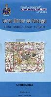
 | 33 - Topographische Landkarte Portugal 1:25.000 Carta Militar de Portugal - Série M888 Instituto Geográfico do Exército (IGeoE) - Portugal |
 | 350-4 ALMENAR DE SORIA Amtliche topographische Landkarte 1:25.000 Spanien (M.T.N.) 350-4 Mapa Topográfico Nacional de Espana (MTN25) Instituto Geográfico Nacional - CNIG Spanien |
 | 2732 12 Sokostovuoma Topographische Karte 1:20.000 (Maastokartta / Peruskartta / Grundkarta) Maanmittauslaitos / Lantmäteriverket Finnland - ProjektNord |
 | 409 Calatayud Amtliche topographische Landkarte 1:50.000 Spanien (M.T.N.) 409 Mapa Topográfico Nacional de Espana (MTN50) Instituto Geográfico Nacional - CNIG Spanien |
 | 7436 Au Hallertau Topographische Landkarte Bayern 1:25.000 - Normalausgabe - ProjektNord (geplottete Ausgabe) - Grundlage amtliche Topographische Karte Bayern DTK25 |
 | 604 Villaluenga de la Sagra Amtliche topographische Landkarte 1:50.000 Spanien (M.T.N.) 604 Mapa Topográfico Nacional de Espana (MTN50) Instituto Geográfico Nacional - CNIG Spanien |
 | 963-1 CANTILLANA Amtliche topographische Landkarte 1:25.000 Spanien (M.T.N.) 963-1 Mapa Topográfico Nacional de Espana (MTN25) Instituto Geográfico Nacional - CNIG Spanien |
 | 805-3 VALLE DE LA SERENA Amtliche topographische Landkarte 1:25.000 Spanien (M.T.N.) 805-3 Mapa Topográfico Nacional de Espana (MTN25) Instituto Geográfico Nacional - CNIG Spanien |
 | 841 Alcaraz Amtliche topographische Landkarte 1:50.000 Spanien (M.T.N.) 841 Mapa Topográfico Nacional de Espana (MTN50) Instituto Geográfico Nacional - CNIG Spanien |
 | 8140 Prien am Chiemsee Topographische Landkarte Bayern 1:25.000 - Normalausgabe - ProjektNord (geplottete Ausgabe) - Grundlage amtliche Topographische Karte Bayern DTK25 |
 | 605-1 ILLESCAS Amtliche topographische Landkarte 1:25.000 Spanien (M.T.N.) 605-1 Mapa Topográfico Nacional de Espana (MTN25) Instituto Geográfico Nacional - CNIG Spanien |
 | 4613 10 Mademurto Topographische Karte 1:20.000 (Maastokartta / Peruskartta / Grundkarta) Maanmittauslaitos / Lantmäteriverket Finnland - ProjektNord |