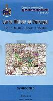
| << Portugal: Amtliche topografische Landkarten des Instituto Geográfico do Exército (IGeoE) 1:25.000 (Serie M888) |
||
|
||

Zuletzt angesehene Artikel:
 | 30 Germil (Ponte da Barca) - Topographische Landkarte Portugal 1:25.000 Carta Militar de Portugal - Série M888 Instituto Geográfico do Exército (IGeoE) - Portugal |
 | 106D - Nash Creek Topographische Landkarte 1:250.000 - Canada - Yukon Territory |
 | 3103 (NL 33-04-03) Lienz Topographische Wanderkarte 1:50.000 mit Wegmarkierungen - Ãsterreich - Kartographie BEV - ProjektNord |
 | 3664 Opalenitza Topographische Karte 1:25.000 Messtischblatt des Deutschen Reiches - PreuÃische Landesaufnahme / Reichsamt für Landesaufnahme - Faksimile ProjektNord |
 | 106E15 Chappie Lake Topographische Landkarte 1:50.000 - Canada - Yukon Territory |
 | 106E11 Topographische Landkarte 1:50.000 - Canada - Yukon Territory |
 | Q16 Ruhpolding - Inzell - Schneizlreuth - Bad Reichenhall-West - Sonntagshorn *** SCHNÃPPCHEN *** ATK25 Topographische Karte 1:25.000 (Atkis) Bayern Landesvermessungsamt Bayern - Wanderkarte - Radwanderkarte |
 | Dnjepr-Bug-Liman (Dnjepr-Mündungsgebiet) - Topographischer Atlas 1:50.000 Atlas Dnjeprowskogo Bassejna - Uste Dnepra - Pritschernomorskie Liman WKF |
 | 5825 Hammelburg Topographische Landkarte Bayern 1:25.000 - Normalausgabe - ProjektNord (geplottete Ausgabe) - Grundlage amtliche Topographische Karte Bayern DTK25 |
 | 7032 Bieswang Topographische Landkarte Bayern 1:25.000 - Normalausgabe - ProjektNord (geplottete Ausgabe) - Grundlage amtliche Topographische Karte Bayern DTK25 |
 | 7527 Günzburg Topographische Landkarte Bayern 1:25.000 - Normalausgabe - ProjektNord (geplottete Ausgabe) - Grundlage amtliche Topographische Karte Bayern DTK25 |
 | P531 Outokumpu Topographische Karte 1:50.000 EUREF-FIN (Maastokarttat) Maanmittauslaitos / Lantmäteriverket Finnland - ProjektNord |
 | 5930 Ebern Topographische Landkarte Bayern 1:25.000 - Normalausgabe - ProjektNord (geplottete Ausgabe) - Grundlage amtliche Topographische Karte Bayern DTK25 |
 | 5632 Neustadt b. Coburg Topographische Landkarte Bayern 1:25.000 - Normalausgabe - ProjektNord (geplottete Ausgabe) - Grundlage amtliche Topographische Karte Bayern DTK25 |
 | 6228 Wiesentheid Topographische Landkarte Bayern 1:25.000 - Normalausgabe - ProjektNord (geplottete Ausgabe) - Grundlage amtliche Topographische Karte Bayern DTK25 |
 | Nationalpark Tara 1:50.000 - Serbien Topographische Wanderkarte Национални парк Тара (Србија) ProjektNord |
 | 15 Velas (S. Jorge - Azoren) - Topografische Karte Portugal 1:25.000 Carta Militar de Portugal - Série M889 - 1/25 000 (Acores) - Instituto Geográfico do Exército (IGeoE) - Portugal |
| 208/219 Vradiievka / Shyriaievo - Amtliche topographische Landkarte 1:100.000 der Ukraine Kiewskaja Wojenno-Kartografitscheskaja Fabrika Ukraine |
 | 10100 Sørli Topographische Landkarte 1:50.000 Norge-serien - Nordeca Norwegen |
 | N5422 Viinijärvi Topographische Karte 1:25.000 EUREF (Peruskartta) Maanmittauslaitos / Lantmäteriverket Finnland - ProjektNord |