| << Portugal: Amtliche topografische Landkarten des Instituto Geográfico do Exército (IGeoE) 1:25.000 (Serie M888) |
||
|
||

Zuletzt angesehene Artikel:
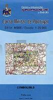
 | 29 - Topographische Landkarte Portugal 1:25.000 Carta Militar de Portugal - Série M888 Instituto Geográfico do Exército (IGeoE) - Portugal |
 | 220 Topographische Landkarte Wanderkarte und Fahrradkarte Portugal 1:25.000 220 Mapa topográfico - Mapa de caminhadas - Portugal 1:25.000 ProjektNord |
 | 2214-II-Nà Ãstbirk Topographische Karte Dänemark 1:25.000 Topografisk kort Danmark (DTK/Kort25) 2214-II-Nà ProjektNord - Kort & Matrikelstyrelsen / Geodætisk Institut |
 | 2317-IV-Sà Topographische Karte Dänemark 1:25.000 Topografisk kort Danmark (DTK/Kort25) 2317-IV-Sà ProjektNord - Kort & Matrikelstyrelsen / Geodætisk Institut |
 | 2116-III-Nà Topographische Karte Dänemark 1:25.000 Topografisk kort Danmark (DTK/Kort25) 2116-III-Nà ProjektNord - Kort & Matrikelstyrelsen / Geodætisk Institut |
 | 292 SANT LLORENà DE MORUNYS Amtliche topographische Landkarte 1:50.000 Spanien (M.T.N.) 292 Mapa Topográfico Nacional de Espana (MTN50) Instituto Geográfico Nacional - CNIG Spanien |
 | 238 Villagonzalo Pedernales Amtliche topographische Landkarte 1:50.000 Spanien (M.T.N.) 238 Mapa Topográfico Nacional de Espana (MTN50) Instituto Geográfico Nacional - CNIG Spanien |
 | 230-2 TABUYO DEL MONTE Amtliche topographische Landkarte 1:25.000 Spanien (M.T.N.) 230-2 Mapa Topográfico Nacional de Espana (MTN25) Instituto Geográfico Nacional - CNIG Spanien |
 | 2011 14 HISSKÃRET Topographische Karte 1:20.000 (Maastokartta / Peruskartta / Grundkarta) Maanmittauslaitos / Lantmäteriverket Finnland - ProjektNord |
 | 272 Topographische Landkarte Wanderkarte und Fahrradkarte Portugal 1:25.000 272 Mapa topográfico - Mapa de caminhadas - Portugal 1:25.000 ProjektNord |
 | 2014 02 Tenala Topographische Karte 1:20.000 (Maastokartta / Peruskartta / Grundkarta) Maanmittauslaitos / Lantmäteriverket Finnland - ProjektNord |
 | 228 Quiaios (Figueira da Foz) Topographische Landkarte Wanderkarte und Fahrradkarte Portugal 1:25.000 228 Mapa topográfico - Mapa de caminhadas - Portugal 1:25.000 ProjektNord |