| << Portugal: Amtliche topografische Landkarten des Instituto Geográfico do Exército (IGeoE) 1:25.000 (Serie M888) |
||
|
||

Zuletzt angesehene Artikel:
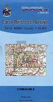
 | 18 - Topographische Landkarte Portugal 1:25.000 Carta Militar de Portugal - Série M888 Instituto Geográfico do Exército (IGeoE) - Portugal |
 | Parco dell`Aveto Foglio Est e Sud - Provincia di Genova 1:25.000 (Blatt GE-15) Carta dei Sentieri Topographische Wanderkarte EdM - Edizioni del Magistero - Italien |
 | 100-2 DEGAÃA Amtliche topographische Landkarte 1:25.000 Spanien (M.T.N.) 100-2 Mapa Topográfico Nacional de Espana (MTN25) Instituto Geográfico Nacional - CNIG Spanien |
 | L2508 Norden (geplottete Ausgabe) Topographische Karte 1:50.000 Kartografie Landesvermessungsamt Niedersachsen - ProjektNord |
 | Aisne Sud à VTT - vol. 2 - Nord / Picardie / Champagne Wanderführer - Mountainbikeführer (französisch) Aisne Sud à VTT - vol. 2 - Nord / Picardie / Champagne - Itinéraires VTT & vélo - carto-guide: fiches+livret pratique Chamina - Frankreich |
 | CC 5502 Köln Geologische Ãbersichtskarte 1:200.000 - Bundesanstalt für Geowissenschaften und Rohstoffe (BGR) |
 | 607 Moncarapacho (Olhao) Topographische Landkarte Portugal 1:25.000 Carta Militar de Portugal - Série M888 Instituto Geográfico do Exército (IGeoE) - Portugal |
 | Chaudfontaine 15 Wanderungen & GR57, GR573 - 2 MTB-Touren NGI 1:15.000 Touristische Landkarte und Wanderkarte Belgien NGI Belgien |
 | 150 - Topographische Landkarte Portugal 1:25.000 Carta Militar de Portugal - Série M888 Instituto Geográfico do Exército (IGeoE) - Portugal |
 | Königshütte - Siemianowitz-Laurahütte - Schwientochlowitz Stadtplan 1:20.000 *** SCHNÃPPCHEN *** Chorzów - Siemianowice Śląskie - Świętochłowice plan miasta Europilot Daunpol - Polen |
 | 147 Sierra de Liena Amtliche topographische Landkarte 1:50.000 Spanien (M.T.N.) 147 Mapa Topográfico Nacional de Espana (MTN50) Instituto Geográfico Nacional - CNIG Spanien |
 | 141 Lidi di Ravenna 1:50.000 Topographische Wanderkarte - Monti editore - Italien Carta turistica e dei sentieri dei Lidi di Ravenna |
 | 172 - Topographische Landkarte Portugal 1:25.000 Carta Militar de Portugal - Série M888 Instituto Geográfico do Exército (IGeoE) - Portugal |
 | 643 Sa Calobra - Mallorca Amtliche topographische Landkarte 1:50.000 Spanien (M.T.N.) 643 Mapa Topográfico Nacional de Espana (MTN50) Instituto Geográfico Nacional - CNIG Spanien |
 | 173 - Topographische Landkarte Portugal 1:25.000 Carta Militar de Portugal - Série M888 Instituto Geográfico do Exército (IGeoE) - Portugal |
 | 111 - Topographische Landkarte Portugal 1:25.000 Carta Militar de Portugal - Série M888 Instituto Geográfico do Exército (IGeoE) - Portugal |
 | 134 - Topographische Landkarte Portugal 1:25.000 Carta Militar de Portugal - Série M888 Instituto Geográfico do Exército (IGeoE) - Portugal |
 | 183 - Topographische Landkarte Portugal 1:25.000 Carta Militar de Portugal - Série M888 Instituto Geográfico do Exército (IGeoE) - Portugal |
 | CC 7110 Mannheim Bodenübersichtskarte 1:200.000 - Bundesanstalt für Geowissenschaften und Rohstoffe (BGR) |
 | 5408 Bad Neuenahr-Ahrweiler - Wanderkarte mit Wanderwegen (geplottete Ausgabe) ProjektNord - Grundlage Amtliche topographische Karte Landesamt für Vermessung und Geobasisinformation Rheinland-Pfalz |