| << Spanien: Wanderkarten - ICGC (ICC) - Institut Cartogrà fic i Geològic de Catalunya |
||
|
||

Zuletzt angesehene Artikel:
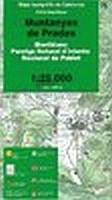
 | Muntanyes de Prades (Blatt 76) 1:25.000 Montblanc - Paratge Natural d`Interès Nacional de Poblet - Wanderkarte Katalonien (Spanien) - Col·lecció Unitats Geogrà fiques - Institut Cartogrà fic de Catalunya |
 | NA510 Panchase Trek (Annapurna) Trekkingkarte 1:50.000 Himalayan MapHouse - Nepal |
 | 9 Kalmar 1:50.000 (wasserfest) Topographische Wanderkarte - Sverigeserien Topo50 - Schweden Kartförlaget |
 | 134 Veporske Vrchy Wanderkarte Slowakei 1:50.000 - VKU |
 | 30 Owaka Topographische Landkarte Neuseeland 1:250.000 Land Information New Zealand |
 | Sant Llorenc del Munt i l`Obac E25 1:25.000 *** SCHNÃPPCHEN *** Wanderkarte Spanien - ALPINA |
 | Lunigiana Orientale 1:25.000 - Foglio 5 Wanderkarte GEOMEDIA - Italien |
 | Israel 1:450.000 - Internationale Landkarte - Cartographia |
 | Navarra Landkarte 1:200.000 Spanien - Provinzkarte - CNIG Navarra - Mapa Provincial Centro Nacional de Información Geográfico |
 | el Montnegre i el Corredor (Blatt 69) 1:25.000 Alt Maresme, Baix Montseny - Wanderkarte Katalonien (Spanien) - Col·lecció Unitats Geogrà fiques - Institut Cartogrà fic de Catalunya |
 | Finnland StraÃenkarte 1:1.25 Mio. (Blatt 754) Michelin |
 | Stettin - Swinemünde - Insel Wollin Mit Stadtplänen und Tourenkarten - von Wolfgang Kling - via reise |
 | 037 Pfunderer Berge - Hochfeiler / Monti di Fundres - Gran Pilastro Topographische Wanderkarte 1:25.000 - Casa Editrice Tabacco - Italien |
 | Jablanica 1:33.333 Wanderkarte Balkan Hiking Adventure |
 | Ive Stadtplan 1:8.000 / Juratischki 1:10.000 und Ivyevsky Kreiskarte 1:100.000 Ивье - Юратишки - Ивьевский район - Belkartographia WeiÃrussland |
 | Hodmezövasarhely Stadtplan 1:14.000 Hódmezõvásárhely Hiszi-Map Ungarn |
 | Island Touristenkarte 1:500.000 Iceland - Islande Touring map - Carte Touristique Icelandroadmap |
 | Hasi Präfektur-Landkarte Albanien 1:70.000 GPS (Blatt 361) wasserfest Vektor Editions - Albanien |
 | 2034 Wismar N Amtliche Topographische Karte 1:25.000 Landesvermessungsamt Mecklenburg-Vorpommern |
| 6322 Hardheim Topographische Landkarte 1:25.000 - Landesvermessungsamt Baden-Württemberg |