| << Spanien: Wanderkarten - ICGC (ICC) - Institut Cartogrà fic i Geològic de Catalunya |
||
|
||

Zuletzt angesehene Artikel:
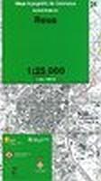
 | Reus (Blatt 24) 1:25.000 - Wanderkarte Katalonien (Spanien) - Col·lecció Capitals Comarcals - Institut Cartogrà fic de Catalunya |
 | Griechenland 1:1.3 Mio. Landkarte GREECE - European Road Map - Internationale Landkarte - Cartographia |
 | Italien Nord + Süd 1:650.000 StraÃenkarte (Doppelkarte) Kümmerly + Frey |
 | Moianès (Blatt 65) 1:25.000 - Wanderkarte Katalonien (Spanien) - Col·lecció Unitats Geogrà fiques - Institut Cartogrà fic de Catalunya |
 | Valsugana Reiseführer - Caldonazzosee und Levicosee - von Robert Hüther - Zwischenräume |
 | Champagne - Ardennen 47 Touren - Zwischen Belgien, Lothringen, Burgund und Paris - Wanderführer - Bergverlag Rother |
 | Gironès (Blatt 20) 1:50.000 Wanderkarte Spanien - ICC - Institut Cartogrà fic de Catalunya |
 | Norwegen 1:900.000 Landkarte (engl.) Norway - Svalbard ITMB International Travel Maps (engl.) |
 | Elbsandsteingebirge - Die schönsten Touren der Sächsischen Schweiz mit Malerweg - Rother Wanderführer - Bergverlag Rother |
 | Rund um Freiburg Zwischen Kaiserstuhl und Hochschwarzwald. 65Touren. GPS - von Walter Iwersen, Elisabeth van de Wetering - Bergverlag Rother |
 | KOMPASS Radvergnügen Kärnten 21 1/2 Feierabend-Rides, Tagestouren & Wochenend-Bikeaways - von Arneitz, Anita - KOMPASS-Karten |
 | Kolumbien Landkarte (Blatt 3405) AdventureMap wasserfest Colombia National Geographic |
 | Die schönsten Radtouren im Chiemgau Radwanderführer BVA Bielefelder Verlag |
 | Alpe-Adria-Trail OutdoorHandbuch - Der Weg ist das Ziel (Band 420) - Thomas Conrad-Stein-Verlag |
 | San Carlos de Bariloche - Trekkingkarte 1:150.000 - Argentinien ProjektNord |
 | Atlantische Pyrenäen - San Sebastian StraÃenkarte Zoom 1:150.000 (Blatt 144) Michelin Spanien |
 | Bäder und Quellen im Szeklerland 1:250.000 (Blatt 26) Székelyföld borvÃztérképe - DIMAP |
 | 101 Safaris - Traumziele in Afrika Reisehandbuch Iwanowski´s Reisebuchverlag |
 | Radvergnügen Ruhrgebiet 21 1/2 Feierabend-Rides, Tagestouren & Wochenend-Bikeaways - von Machoczek, Thomas Münch, Susanne Peters, Ulrike Katrin - KOMPASS-Karten |
 | Georgien Kleiner und GroÃer Kaukasus. 48 Touren. Mit GPS-Tracks - Wanderführer von Nina Kramm - Bergverlag Rother |