 Detailreiche Straßenkarte der Region Makedonien im Norden Griechenlands mit Höhenlinen. Die Landkarte ist wasserfest und reißfest (plastifiziert). Mit Papp-Cover (entfernbar) und Ortsverzeichnis. Blattübersicht der ANAVASI-Karten:  Griechenland Nord und Mitte Nord-Ägäis Griechenland Nord und Mitte Nord-Ägäis
Peloponnes Ägäis Kreta Kartenausschnitt
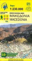
Kartenbeispiel
|
Makedonien - Topographische Straßenkarte Griechenland 1:230.000 (Blatt R4) Anavasi - Griechenland
Macedonia - Μακεδονια - Greece Regional Maps
EAN / ISBN: 9789609412100
Preis: EUR 11.80
|
| 


