| << Gitashenasi - Iran |
||
|
||

Zuletzt angesehene Artikel:
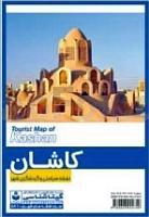
 | Kashan City Tourist Map (Farsi & English) 1:14.000 Stadtplan (581) نقشه سیاحتی و گردشگری شهر کاشان Gitashenasi - Iran |
 | 2787 04 Janak Himal - Yanma (4) 1:50.000 FINN MAPS - HMG Nepal |
 | 2504 MAGGLINGEN/MACOLIN 1:25.000 Zusammensetzung Topographische Landeskarte der Schweiz - swisstopo |
| BD38 Topographische Landkarte Neuseeland 1:50.000 Land Information New Zealand |
| M-33-17/18 Spremberg Plot aus der Kartengrundlage der amtliche topographische Karte Polen 1:100.000 ProjektNord |
 | Urlaub in der Natur in Lettland, Litauen und Estland 1:1 Mio (englisch / lettisch) Dabas Brivdienas Latvija, Lietuva, Igaunija / Nature Holidays Map Latvia, Lithuania, Estonia Lauku Celotajs - Baltic Country Holidays |
 | 453 Benbecula & South Uist / Beinn na Faoghla agus Uibhist a Deas, Eriskay - Wanderkarte Großbritannien 1:25.000 EXPLORER MAP - Ordnance Survey |
| L8514 Laufenburg (Baden) Topographische Landkarte 1:50.000 - Landesvermessungsamt Baden-Württemberg |
 | 65 BASTOGNE NGI 1:50.000 Topographische Karte Belgien |
| M-33-7-A/B Swidnica Amtliche topographische Landkarte Polen 1:50.000 M-33-7-A/B Swidnica - Mapa Topograficzna Polski Glowny Geodeta Kraju |
 | 05 Pizzo Badile - Blumone e Crocedomini 1:25.000 - Valle Camonica - La Valle dei Segni - Wanderkarte - Ingenia Editori - Italien |
 | 3436ET MEIJE - PELVOUX - PARC DES ECRINS Topographische Wanderkarte Frankreich 1:25.000 TOP 25 IGN |
| Marysville / Yuba City / Grass Valley / Nevada City Stadtplan 1:32.000 / 1:28.000 (Kalifornien - USA) Marysville / Yuba City / Grass Valley / Nevada City street map American Automobile Association |
 | Canyonlands National Park - Maze North East Glen Canyon - Utah 1:62.500 (Blatt 246) Landkarte - Trails Illustrated Map - National Geographic - USA |
 | 51/3-4 QUEVY - ROUVEROY NGI 1:25.000 Topographische Landkarte Belgien |
 | Samoborsko Gorje (14) Topographische Wanderkarte - Serie Kroatien kontinental Samoborsko Gorje - Serija Kontinentalna Hrvatska - Mountaineering and Hiking map - Croatian Mountain Rescue Service Kroatischer Bergrettungsdienst - Kroatien |
 | Bechyňsko 1:25.000 (Blatt 92) Topographische Wanderkarte 1:25.000 Geodezie On Line - Tschechien |
 | Belgien & Luxemburg 1:350.000 Straßenkarte (Blatt 716) Michelin |
| M-34-62-A/B Gliwice Amtliche topographische Landkarte Polen 1:50.000 M-34-62-A/B Gliwice - Mapa Topograficzna Polski Glowny Geodeta Kraju |
| M-34-21-C/D Kurow Amtliche topographische Landkarte Polen 1:50.000 M-34-21-C/D Kurow - Mapa Topograficzna Polski Glowny Geodeta Kraju |