| << Gitashenasi - Iran |
||
|
||

Zuletzt angesehene Artikel:
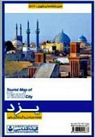
 | Yazd City Tourist Map (Farsi & English) 100 - 1:18.000 Stadtplan (562) نقشه راهنمای گردشگری شهر یزد Gitashenasi - Iran |
 | 1940 Tessin Amtliche Topographische Karte 1:25.000 Landesvermessungsamt Mecklenburg-Vorpommern |
 | 7713 Schuttertal Topographische Landkarte 1:25.000 - Landesvermessungsamt Baden-Württemberg |
 | 712 Bjurholm - Terrängkartan 1:50.000 Topographische Wanderkarte Schweden - Lantmäteriet Landkarte Schweden |
 | 1447 Sassnitz Amtliche Topographische Karte 1:25.000 Landesvermessungsamt Mecklenburg-Vorpommern |
 | Skandinavien (Norden) laminierte WANDKARTE 77,4 x 102 cm |
 | Rund um Hamburg - Holsteinische Schweiz bis Lüneburger Heide - Rother Wanderführer - Bergverlag Rother |
 | Saigon - Ho-Chi-Minh-Stadt CityTrip - von Lars Dörenmeier - Reise Know-How |
 | 3446OT HYERES / ILE DE PORQUEROLLES Topographische Wanderkarte Frankreich 1:25.000 TOP 25 IGN |
| Montsec d`Ares (Blatt 60) 1:25.000 Congost de Mont-rebei, Pas de Terradets, Àger - Wanderkarte Katalonien (Spanien) - Col·lecció Unitats Geogràfiques - Institut Cartogràfic de Catalunya |
| 3124SB SEURRE - SAINT-JEAN-DE-LOSNE GPS Amtliche Topographische Wanderkarte Frankreich 1:25.000 - série bleue (IGN) |
 | Dominikanische Republik und Haiti 1:400.000 / 1:350.000 (wasserfest) Landkarte - ITMB International Travel Maps (engl.) Dominican Republic, Haiti |