| << Finnland: Gewässerkarten, Wassersportkarten |
||
|
||

Zuletzt angesehene Artikel:
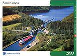
 | Saimaa-Kanal Gewässerkartenserie S - 1:10.000 Saimaan kanava Sisävesikarttasarja S 1:10.000 Finnland |
 | 25114 Brienzer Rothorn - Serie Gipfel 1:25.000 Schratteflue - Sörenberg - Giswilerstock - Topographische Wanderkarte der Schweiz - swisstopo |
 | Landkreis Vorpommern-Greifswald Topographische Kreiskarte 1:100.000 Landesvermessungsamt Mecklenburg-Vorpommern |
 | Naturpark Altmühltal 1:50.000 - Hikeline Wanderführer 18 Schlaufenwege um den Panoramaweg und 22 Rundtouren im Herzen Bayerns. 40 Touren, 540 km. GPS Tracks Download. Wasserfest - von Michael Moll - Esterbauer |
 | Walks around Ambleside: Grasmere - Langdale & Etterwater - Wanderkarte A map-guide to 14 walks around Ambleside, in the English Lake District - Footprint Maps - Stirling Surveys |
 | 4443 Dreiheide - Torgau West Amtliche Topographische Landkarte 1:25.000 (Präsentationsgrafik) - Landesvermessungsamt Sachsen |
 | 060 N Fjaler NORD 1:50.000 - Amtliche Topographische Landkarte Norwegen - Startens Kartverk |