 Amtliche topographische Karte Bayern 1:50.000. Diese Blätter werden nur noch in der geplotteten Ausgabe vertrieben. Der Preis setzt sich zusammen aus 6 EUR Ladenpreis + 11,90 EUR Servicekosten für den Einzeldruck.  Kartenbeispiel aus der Serie Kartenbeispiel aus der Serie
Blattschnitte Nordwest Blattschnitte Nordost Blattschnitte Südwest Blattschnitte Südost Kartenausschnitt
|
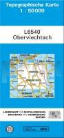
L6540 Oberviechtach (geplottete Ausgabe) Topographische Karte Bayern 1:50.000 Bayerisches Landesvermessungsamt
EAN / ISBN: 9783860383469
Preis: EUR 17.90
|
| 

