Willkommen bei MapFox
Wurde Ihre Bestellung bestätigt? Wenn nicht - gab es evtl. ein SERVER-Problem! Bitte kontaktieren Sie uns! +++ Buchhändler-Anfragen erwünscht +++
Warenkorb
Artikel: 0 - € 0.00
Zur Kasse
Widerruf Impressum Kontakt Versandkosten AGB
CL803 Island Peak Climbing Map 1:40.000 Himalayan MapHouse - Nepal
Island Peak - Imja Tse
<< Nepal: Trekkingkarten
<< Himalayan Map House
 
Cover

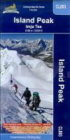
Detaillierte topografische Landkarte über die Route von Lukla bis zum Island Peak Gipfel.
Koordinaten des Blattschnittes:
27°47´ N/86°42´ O bis 27°56´N/86°57´ O.

Mit Trekkingrouten, Entfernungsangaben und Höhenlinien.
Schwierigkeitsgrad: sehr schwierig
7 - 10 Tage
Höhenbereich: 2.840m - 6.189m
Route: Lukla, Monjo, Namche Bazar, Chhukhung, Pareshaya Gyab, High Camp, Island Peak Summit.

Kartenausschnitt

Kartenbeispiel

CL803 Island Peak Climbing Map 1:40.000 Himalayan MapHouse - Nepal
Island Peak - Imja Tse
EAN / ISBN: 9799993323005
Preis: EUR 23.50

sofort versandfertig Dieser Artikel ist im Normalfall sofort lieferbar.
Produkt EUR Anzahl Bestellen
CL803 Island Peak Climbing Map 1:40.000 Himalayan MapHouse - Nepal
Island Peak - Imja Tse
23.50
Versandkostenfrei in Deutschland ab 30,- Bestellwert

incl. MwSt.

Stichworte, die bei der Suche nützlich sein könnten:
Island Peak Summit - High Camp - Monjo - Namche Bazar - Imja Tse - Island Peak - Nepal - Pareshaya Gyab - Chhukhung - Lukla - Himalayan Map House - Nepal - Himalaya Trekkingkarten - Nepal Landkarten - Nepal Trekkingkarten - Nepal Wanderkarten

Zuletzt angesehene Artikel:

CoverCL803 Island Peak Climbing Map 1:40.000 Himalayan MapHouse - Nepal
Island Peak - Imja Tse

Cover385 Gran Paradiso 1:25.000 Valle di Cogne - Wanderkarte 4land
Carta escursionistica del Gran Paradiso, versante Valle di Cogne 4land

CoverSerra de Pinós 1:30.000 - Blatt 5 Excursions al centre geogràfic de Catalunya, per la Vall del Llobregós, Torà, Llanera, Ardèvol i els Plans de la Molsosa - Wanderkarte Pyrenäen Spanien - Monteditorial

Cover8 Monte Rosa - Ayas - Gressoney - Alagna 1:25.000 (wasserfest) Topographische Wanderkarte l`Escursionista Editore - Italien

Cover2521SB ST-FARGEAU - NEUVY-SUR-LOIRE GPS Amtliche Topographische Wanderkarte Frankreich 1:25.000 - série bleue (IGN)

Noch kein Cover vorhandenAV27 Topographische Landkarte Neuseeland 1:50.000 Land Information New Zealand