Willkommen bei MapFox
Wurde Ihre Bestellung bestätigt? Wenn nicht - gab es evtl. ein SERVER-Problem! Bitte kontaktieren Sie uns! +++ Buchhändler-Anfragen erwünscht +++
Warenkorb
Artikel: 0 - € 0.00
Zur Kasse
Impressum Kontakt Versandkosten AGB
Island 4 Stadfraedikort 1:50.000 CD-ROM *** SCHNÄPPCHEN ***
KORTADISKUR 4 - Staðfræðikort
<< Island
<< Schnäppchen - Restposten - Mängelexemplare
 
(Titelbild evtl. abweichend)
Cover

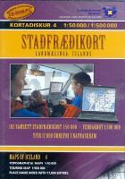
Box leicht beschädigt, daher zum Sonderpreis.

The CD includes a Touring Map on a scale of 1:500 000 that shows the entire country, and 102 Topographical Maps DMA on a scale of 1:50 000 that covers about half of Iceland. The main improvement over the older edition is that there are considerably more place-names. All place-names on maps on a scale of 1:250 000 and 1:500 000 are searchable. Place-names total about 17,000.

Klicken Sie hier, wenn Sie diesen Artikel in der Version zum normalen Preis sehen möchten.

Kartenausschnitt

Kartenbeispiel

Island 4 Stadfraedikort 1:50.000 CD-ROM *** SCHNÄPPCHEN ***
KORTADISKUR 4 - Staðfræðikort
EAN / ISBN: 9789979750468
Preis: EUR 20.00

sofort versandfertig Dieser Artikel ist im Normalfall sofort lieferbar.
Produkt EUR Anzahl Bestellen
Island 4 Stadfraedikort 1:50.000 CD-ROM *** SCHNÄPPCHEN ***
KORTADISKUR 4 - Staðfræðikort
20.00
Versandkostenfrei in Deutschland ab 30,- Bestellwert

incl. MwSt.

Stichworte, die bei der Suche nützlich sein könnten:
Island Landkarten-CD - Staðfræðikort Island CD - Iceland CDROM - Island CD Stadfrädikort - Island - Iceland - Schnäppchen - Sonderangebote - Restposten

Zuletzt angesehene Artikel:

CoverIsland 4 Stadfraedikort 1:50.000 CD-ROM *** SCHNÄPPCHEN ***
KORTADISKUR 4 - Staðfræðikort

Noch kein Cover vorhanden145.44 Amtliche topographische Karte 1:25.000 Polen

Cover10 Monte Rosa - Alagna e Macugnaga - Topographische Wanderkarte 1:50.000 - IGC Italien

Cover176 Jaca Amtliche topographische Landkarte 1:50.000 Spanien (M.T.N.)
176 Mapa Topográfico Nacional de Espana (MTN50) Instituto Geográfico Nacional - CNIG Spanien

Cover748 Ila de Conills - Mallorca Amtliche topographische Landkarte 1:50.000 Spanien (M.T.N.)
748 Mapa Topográfico Nacional de Espana (MTN50) Instituto Geográfico Nacional - CNIG Spanien

Cover6514 Bad Dürkheim West - Wanderkarte mit Wanderwegen (geplottete Ausgabe) ProjektNord - Grundlage Amtliche topographische Karte Landesamt für Vermessung und Geobasisinformation Rheinland-Pfalz

Cover168 Briviesca Amtliche topographische Landkarte 1:50.000 Spanien (M.T.N.)
168 Mapa Topográfico Nacional de Espana (MTN50) Instituto Geográfico Nacional - CNIG Spanien

Cover147 Topographische Landkarte Wanderkarte und Fahrradkarte Portugal 1:25.000
147 Mapa topográfico - Mapa de caminhadas - Portugal 1:25.000 ProjektNord

Cover5510 Neuwied - Wanderkarte mit Wanderwegen (geplottete Ausgabe) ProjektNord - Grundlage Amtliche topographische Karte Landesamt für Vermessung und Geobasisinformation Rheinland-Pfalz

Cover177 - Topographische Landkarte Portugal 1:25.000 Carta Militar de Portugal - Série M888 Instituto Geográfico do Exército (IGeoE) - Portugal

CoverUSA Nordwest - Pazifik Nordwest 1:3 Mio. (Blatt 1) *** SCHNÄPPCHEN *** Straßenkarte Borch laminiert
USA 1 Northwest - Pacific Northwest

Cover15 Westelijk Brabant Fahrradkarte 1:75.000
Fietskaart - ANWB - Niederlande

Cover1104 Telde - Gran Canaria Amtliche topographische Landkarte 1:50.000 Spanien (M.T.N.)
1104 Mapa Topográfico Nacional de Espana (MTN50) Instituto Geográfico Nacional - CNIG Spanien

Cover5812 St. Goarshausen - Wanderkarte mit Wanderwegen (geplottete Ausgabe) ProjektNord - Grundlage Amtliche topographische Karte Landesamt für Vermessung und Geobasisinformation Rheinland-Pfalz

Cover1100 Gran Tarajal - Fuerteventura Amtliche topographische Landkarte 1:50.000 Spanien (M.T.N.)
1100 Mapa Topográfico Nacional de Espana (MTN50) Instituto Geográfico Nacional - CNIG Spanien

Cover5 Cervino - Matterhorn e Monte Rosa - Topographische Wanderkarte 1:50.000 - IGC Italien

CoverU5321 Saukkojärvi Topographische Karte 1:25.000 EUREF (Peruskartta) Maanmittauslaitos / Lantmäteriverket Finnland - ProjektNord

Noch kein Cover vorhanden1873 Berent (Westpreußen) Topographische Karte 1:25.000 Messtischblatt des Deutschen Reiches - Preußische Landesaufnahme / Reichsamt für Landesaufnahme - Faksimile ProjektNord

Cover137 Lamego Topographische Landkarte Wanderkarte und Fahrradkarte Portugal 1:25.000
137 Mapa topográfico - Mapa de caminhadas - Portugal 1:25.000 ProjektNord