| << Selas Publications LTD - Zypern |
||
|
||
Zuletzt angesehene Artikel:
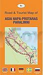
 | Agia Napa - Protaras - Paralimni Pocket Map 1.1:10.100 / 1:24.000 / 1:11.000 - Stadtplan - Selas Publications LTD |
 | Afrika und die Welt - Schüler-Landkarte 1:10 Mio. und 1:50 Mio. Africa & The World Pack Student Map MapStudio |
 | CityTrip Antwerpen, Brügge, Gent CityTrip - Stadtführer Reise-Know-How Verlag |
 | Hainaut / Henegouwen 1:150.000 StraÃenkarte Belgien (Blatt 379) Michelin Local |
 | Walking The Thames Path from London to the river`s source in Gloucestershire - Wanderführer Southern England - Cicerone GroÃbritannien (englisch) |
 | 6013 Bingen am Rhein Topographische Karte 1:25.000 - Landesamt für Vermessung und Geobasisinformation Rheinland-Pfalz |
 | 5629 Römhild Topographische Karte Thüringen 1:25.000 Landesvermessungsamt Thüringen |
 | Klagenfurt am Wörthersee 1:17.500 Stadtplan Freytag & Berndt |
 | 10087 Sylan Topographische Landkarte 1:50.000 Norge-serien - Nordeca Norwegen |
 | 2722ET AVALLON-VEZELAY Topographische Wanderkarte Frankreich 1:25.000 TOP 25 IGN - (GPS) |
| 4048-SO Topographische Karte 1:10.000 - Landesvermessungsamt Brandenburg |
 | USA-West 1:3.5 Mio. Landkarte Hildebrand`s Urlaubskarten |
 | 047 Tobermory & North Mull - Wanderkarte GroÃbritannien 1:50.000 LANDRANGER MAP - Ordnance Survey |
 | Hinterhermsdorf und die Schleusen Wanderkarte 1:10.000 - Rolf Böhm Verlag |
| 3743-SO Topographische Karte 1:10.000 - Landesvermessungsamt Brandenburg |
| 135.2 Naleczow Amtliche topographische Karte 1:50.000 Polen |
 | OL44 Torquay & Dawlish - Wanderkarte GroÃbritannien 1:25.000 EXPLORER MAP - Ordnance Survey |
 | Pacific Northwest - StraÃenkarte USA Road Guide 1:1 Mio (Blatt 1) - Hallwag |
 | Top MTB Trails South Africa - Fahrradatlas Südafrika - MapStudio Südafrika |
 | Litauisch - Wort für Wort Kauderwelsch-Sprachführer (Band 054) Litauen - Reise-Know-How Verlag |