| << Finnland << Genimap / Karttakeskus Finnland |
||
|
||

Zuletzt angesehene Artikel:
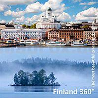
 | Finland 360° The most beautiful places and sights - Bildband Karttakeskus - Genimap Finnland |
 | Balkan Classic PLANO-Karte 1:1.948 Mio. (Format: 77 x 60 cm) - gerollt im Plastikrohr Balkans classic flat map National Geographic |
 | 2414 Wilhelmshaven Amtliche topographische Karte 1:25.000 Landesvermessungsamt Niedersachsen |
 | 3111 Sögel Topographische Wanderkarte 1:25.000 Niedersachsen mit Wanderwegen - ProjektNord |
 | Nürnberg - Frankenalb - Frankenhöhe - Steigerwald - Fränkisches Seenland - 55 Touren mit Extra-Tourenkarte - Wanderführer GPS-Daten zum Download - KOMPASS |
 | 228 HOHER FRESCHEN 1:50.000 Topographische Landeskarte der Schweiz - swisstopo |
 | 3744 Wildenbruch Topographische Karte 1:25.000 Landesvermessungsamt Brandenburg (gefaltet) |
 | 4550 Lauta Amtliche Topographische Landkarte 1:25.000 (Präsentationsgrafik) - Landesvermessungsamt Sachsen |
 | Parco Nazionale dello Stelvio - Carta 3 - Valcamonica - Passo Gavia e Val di Rezzalo - Topographische Wanderkarte 1:25.000 Ingenia Editori - Italien |
 | 2637 Marnitz Sonderausgabe mit Wanderwegen - Topographische Wanderkarte Brandenburg 1:25.000 ProjektNord |
 | Chios (Blatt 337) Landkarte Griechische Inseln 1:80.000 Orama - Griechenland Hios - Χίος |
 | ICELAND - Nature Paradise at the Arctic Circle The best hiking trails on the largest volcanic island on Earth - by Uwe Grunewald - Unique-Iceland |
 | Der Oberharz 1:30.000 Wanderkarte und Fahrradkarte - von Bernhard Spachmüller Schmidt-Buch-Verlag |
 | Berlin - Brandenburg (Nr. 5033) Wanderführer mit Extra-Tourenkarte, 75 Touren, GPX-Daten zum Download - von Bernhard Pollmann - KOMPASS-Karten |
 | 5822 Wiesen Topographische Landkarte Hessen 1:25.000 - ProjektNord (geplottete Ausgabe) |
 | Edgeøya (Blatt 2) Spitzbergen / Svalbard / Spitsbergen - Topographische Karte 1:500.000 Norsk Polarinstitutt |
 | VERSAILLES CHEVREUSE RAMBOUILLET - balades et randonnées Wanderführer - (französisch) Chamina - Frankreich |
| 7813 Emmendingen Topographische Landkarte 1:25.000 - Landesvermessungsamt Baden-Württemberg |
| Thousand Oaks / Simi Valley / Moorpark Stadtplan (Kalifornien - USA) Thousand Oaks / Simi Valley / Moorpark street map |
| Santa Cruz / Watsonville Stadtplan 1:32.000 (Kalifornien - USA) Santa Cruz / Watsonville street map GM Johnson |