 Detaillierte Wanderkarte von der Hochebene von Pinè und einem Teil des Cembratals. Die Rückseite der Karte enthält Informationen über 8 ausgewählte Wandertouren und den entsprechenden Profilen dazu. Zusätzlich werden 8 ausgewählte Mountainbike-Touren mit Höhenprofilen und Schwierigkeitsgraden dargestellt. Blattübersicht 1:50.000  Sentiero Italia und Einzelblätter Sentiero Italia und Einzelblätter
Blattübersicht 1:25.000 und detaillierter Westalpen Mittlere Alpen: Südtirol, Dolomiten Toskana Mittelitalien Sardinien Kartenausschnitt
Kartenbeispiel
|
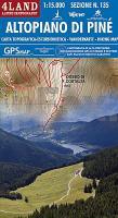
135 Altopiano di Piné 1:15.000 Topographische Wanderkarte - 4land - Italien
EAN / ISBN: 9788889823217
Preis: EUR 14.90
|
| 


