| << Serbien << GEOKARTA d.o.o. |
  | |
Zuletzt angesehene Artikel:
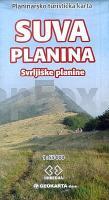
![]() | Suva Planina National Park 1:55.000 Touristische Landkarte Süd-Serbien Geokarta D.O.O. Suva Planina - Svrljiske planine - Planinarsko Turistitschka Karta Geokarta Belgrad |
![]() | Wandern am Wasser Salzkammergut - Bergseen · Schluchten · Klammen · Kaskaden · Wildbäche - Bergverlag Rother |
![]() | 201 S Vuonnabahta SØR 1:50.000 - Amtliche Topographische Landkarte Norwegen - Startens Kartverk |
![]() | Wintersportkarte Sumava - Bayerischer Wald, Böhmerwald 1:75.000 - SHOCart - Tschechien |
![]() | Stettin 1941 Historischer Stadtplan 1:18.000 Nachdruck Szczecin - Pharus-Plan |
![]() | N-34-74-C/D Kwidzyn Amtliche topographische Landkarte Polen 1:50.000 N-34-74-C/D Kwidzyn - Mapa Topograficzna Polski Glowny Geodeta Kraju |
![]() | 214 Böhmerwald Touristische Landkarte Tschechien 1:100.000 Sumava - SHOCart |
![]() | Politisch-Administrativer Atlas der Ukraine (Hardcover) Politiko-Administraiwnij Atlas Ukraini Kartografija - ukrmap Ukraine |
![]() | 61 Niederrhein - Kleve - Wesel - Kevelaer - Xanten - Bocholt 1:50.000 Outdoorkarte - Wanderkarte Kümmerly & Frey |
![]() | 2: Nikkaluokta - Sarek - Saltoluokta 1:75.000 - Outdoorkarte / Fjällkarte - wasserfest Norstedts - Schweden |
![]() | F524 Freizeitkarte Bad Urach - Biosphärengebiet Schwäbische Alb 1:50.000 - Landesvermessungsamt Baden-Württemberg |
![]() | Schleswig-Holstein 1:250.000 - POSTER Topographische Landkarte ca. 90 x 80 cm Bundesamt für Kartographie und Geodäsie - ProjektNord |
![]() | 22-b Topographische Landkarte Georgien 1:50.000 Geoland Maps Georgien |
![]() | 2 Spa 1:25.000 - 820 km Wanderwege Touristische Landkarte und Wanderkarte, Radwanderkarte, Reitkarte - Mini Ardenne - Belgien |
![]() | Southern Peloponnese Sunflower-Wanderführer - englisch - kostenlose Updates - car tours & walks |
![]() | St. Helena and Dependencies - British Overseas Territories Straßenkarte 1:35.000 - GiziMap |
![]() | 2575 Heinrichsdorf Topographische Karte 1:25.000 Messtischblatt des Deutschen Reiches - Preußische Landesaufnahme / Reichsamt für Landesaufnahme - Faksimile ProjektNord |
![]() | Sewastopol (Krim) Stadtplan 1:20.000 (lateinische Ausgabe) Sevastopol` plan goroda Kartografija - ukrmap Ukraine |
![]() | Segelhandbuch der Adria Herausgegeben vom Hydrographischen Amte der K. u. k. Kriegsmarine - Pola 1906 Repräsentativer Nachdruck von 1906 |
![]() | Sudan und Südsudan Geographische Straßenkarte 1:2.5 Mio. Sudan and South-Sudan GiziMap |


