| << Spanien: Wanderkarten - EDITORIAL PIOLET << Editorial Piolet s.l. |
  | |
|
||
Zuletzt angesehene Artikel:
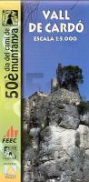
![]() | Vall de Cardó 1:5.000 50è dia del camí de Muntanya - Wanderkarte - Editorial Piolet - Spanien |
![]() | Oborniki Slaskie (Obernigk) und Umgebung Stadtplan 1:8 500 Stadtplan/Landkarte Oborniki Śląskie mapa PLAN Galileos - Polen |
![]() | 3170 Stempuchowo Topographische Karte 1:25.000 Messtischblatt des Deutschen Reiches - Preußische Landesaufnahme / Reichsamt für Landesaufnahme - Faksimile ProjektNord |
![]() | 3869 Sulencin Topographische Karte 1:25.000 Messtischblatt des Deutschen Reiches - Preußische Landesaufnahme / Reichsamt für Landesaufnahme - Faksimile ProjektNord |
![]() | 323.14 Amtliche topographische Karte 1:25.000 Polen |
![]() | Santorin (Blatt 10.24) Topografische Wanderkarte griechische Inseln 1:25.000 - Aegean Cyclades - Anavasi - Griechenland Σαντορινη - Santorini - Περιητικος & πεζοπορικος χαρτης - Touring & Hiking Map |
![]() | Cannobio und Umgebung (Nr.17) - Wanderführer (deutsch) - Diegi Ferrari - ZANETTI EDITORE |
![]() | Persisch - Wort für Wort Kauderwelsch-Sprachführer (Band 049) Reise-Know-How Verlag |
![]() | Falk Stadtplan Extra Standardfaltung Paderborn + Umgebungskarte Mit Ortsteilen von Bad Lippspringe, Borchen |
![]() | 158 Tenby & Pembroke / Dinbych-y-pysgod a Penfro - Wanderkarte Großbritannien 1:50.000 Active Laminiert LANDRANGER MAP - Ordnance Survey |
![]() | L6740 Neunburg vorm Wald (geplottete Ausgabe) Topographische Karte Bayern 1:50.000 Bayerisches Landesvermessungsamt |
![]() | Irland Laminierte PLANO-Karte 1:550.000 (Format: 76 x 91 cm) - gerollt im Plastikrohr Ireland flat map - laminated National Geographic |
![]() | Alta Ruta de los perdidos 1:25.000 Monte Perdido - Vignemale - Wanderkarte Spanien - ALPINA |
![]() | La Cornouaille par la pointe du Raz GR34 - 38 - Réf. 0348 Topographischer Wanderführer - FFRP (Fédération française de randonnée pédestre) Frankreich |
![]() | Adelaide Insel - Arrowsmith Halbinsel 1:250.000 Landkarte British Antarctic Survey Adelaide Island and Arrowsmith Peninsula |
![]() | Baedeker Reiseführer USA Südwesten von Linde, Helmut u. Pinck, Axel |
![]() | Hike and Rail: Alps - Pyrenees - Corsica Long distance walks and rail network - Alta Via - Belgien |
![]() | 4118 Die Senne (geplottete Ausgabe) Amtliche topographische Karte 1:25.000 Landesvermessungsamt Nordrhein-Westfalen |
![]() | Südwest-Island Wanderkarte 1:75.000 (Blatt 1) Suðvesturland sérkort - Landmælingar - Island |


