| << Polen: Wanderkarten: Beskiden (Tatra, Vorkarpaten) << EKO-Graf Polen |
||
|
||
Zuletzt angesehene Artikel:
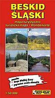
 | Schlesische Beskiden Landkarte 1:50.000 Touristische Landkarte Beskid Śląski mapa EkoGraf - Polen |
 | Park Natural de la Serra d´Irta 1:20.000 Illes Columbretes 1:5.000 - Peniscola - Alcalà de Xivert - Wanderkarte 1:20.000 - Editorial Piolet - Spanien |
 | Teutoburger Wald 6 - Horn-Bad Meinberg - Detmold Topographische Wanderkarte Nordrhein-Westfalen mit Wanderwegen und Radwegen 1:25.000 - ProjektNord |
 | 0889-4 MORATALLA Topographische Landkarte 1:25.000 Spanien (Grundlage MTN25) Instituto Geográfico Nacional - CNIG Spanien - ProjektNord |
 | Q5432 Niemiskylä Topographische Karte 1:25.000 EUREF (Peruskartta) Maanmittauslaitos / Lantmäteriverket Finnland - ProjektNord |
 | 0807-1 PEÃALSORDO Topographische Landkarte 1:25.000 Spanien (Grundlage MTN25) Instituto Geográfico Nacional - CNIG Spanien - ProjektNord |
 | NL 32-03-21 (2221) Imst Ãsterreichische Karte 1:50.000 mit Wegmarkierungen (topographische Wanderkarte - UTM) - BEV - Ãsterreich |
 | 09E DE COCKSDORP Topographische Karte der Niederlande 1:25.000 (Plotausgabe) 09E DE COCKSDORP Topografische Kaart van Nederland Kadaster - ProjektNord |
 | 15-42 Topographische Karte 1:50.000 der Tschechischen Republik Zakladnà mapa Ceská republika - Cesky urad zememericky a katastralni - ProjektNord |
 | 2225 Quickborn - Gestern und Heute - Historische Ãberlagerung 1932-1950 Topographische Landkarte 1:25.000 im Vergleich - Landesvermessungsamt Schleswig-Holstein / ProjektNord |
 | Provinz OstpreuÃen um 1910 - Historische Landkarte Nachdruck Planokarte - gerollt von Handtke, Friedrich - Verlag Rockstuhl |
 | 0796 GANDIA Topographische Landkarte 1:50.000 Spanien (Grundlage MTN50) Instituto Geográfico Nacional - CNIG Spanien - ProjektNord |
 | 39W TIEL (West) Topographische Karte der Niederlande 1:50.000 Topografische Dienst (Plotausgabe) |
 | 0643 SA CALOBRA Topographische Landkarte 1:50.000 Spanien (Grundlage MTN50) Instituto Geográfico Nacional - CNIG Spanien - ProjektNord |
| Entdeckungsreisen - Westliche Hemisphäre (Amerika - Pazifik) PLANO-Karte (Format: 51 x 46 cm) - gerollt im Plastikrohr Western Hemisphere flat map of discovery National Geographic |
 | L323 Kustavi Topographische Karte 1:50.000 EUREF-FIN (Maastokarttat) Maanmittauslaitos / Lantmäteriverket Finnland - ProjektNord |
| Merikarvia - Kristiinankaupunki - Kaskinen Hafenkarte 113 - 1:20.000 Merikarvia - Kristiinankaupunki - Kaskinen Satamakartta 113 - 1:20.000 Finnland |
 | C3918 Minden (geplottete Ausgabe) Topographische Landkarte 1:100.000 Landesvermessungsamt Nordrhein-Westfalen |
 | Die schönsten Kanu-Touren in Sachsen - Sachsen-Anhalt und Thüringen 32 Ein- und Zweitagestouren zwischen Elbe und Werra - von Manfred Schröder - DKV-Verlag Deutscher Kanu-Verband |
 | Bulgarisch Rumänische Schwarzmeerküste - 1:150.000 Autokarte Bulgarian and Romanian Black Sea Cost freytag & berndt |