| << Polen: Straßenkarten: Pommern, Ostseeküste << CartoMedia Polen |
||
|
||
Zuletzt angesehene Artikel:
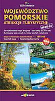
 | Woiwodschaft Pommern Touristische Sehenswürdigkeiten 1:220.000 Touristische Landkarte (Blatt 501) WOJEWÓDZTWO POMORSKIE - ATRAKCJE TURYSTYCZNE Cartomedia - Sygnatura Polen |
 | 48-558 Bad Nauheim - Wetterau Nord 1:25.000 Butzbach, Florstadt, Friedberg (Hessen), Niddatal, Rosbach, Wölfersheim, Wöllstadt - Wanderkarte mit Radwegen - NaturNavi |
 | Festung Kolberg Militärhistorische Landkarte 1:10.000 - Touristische Landkarte Twierdza Kolobrzeg - mapa turystyczna Arkadiusz Wozniakowski - Casamata - Polen |
 | The Heilsberg Triangle Section 4 Tourist map of the fortifications in Gorowo Ilaweckie forest district Militärhistorische Landkarte 1:20.000 - Touristische Landkarte Trojkat Lidzbarski odcinek 4 Runowo - Rodnowo. Mapa turystyczna fortyfikacji na terenie nadlesnictwa Gorowo Ilaweckie Arkadiusz Wozniakowski - Casamata - Polen |
 | Befestigungsanlagen auf der Halbinsel Hela Militärhistorische Landkarte 1:20.000 Mapa fortyfikacji Polwyspu Helskiego - Map of Hel Peninsula Fortifications Arkadiusz Wozniakowski - Casamata - Polen |
| 1686 Eisenberg in Ostpreußen Topographische Karte 1:25.000 Messtischblatt des Deutschen Reiches - Preußische Landesaufnahme / Reichsamt für Landesaufnahme - Faksimile ProjektNord |
 | 205 Topographische Landkarte Wanderkarte und Fahrradkarte Portugal 1:25.000 205 Mapa topográfico - Mapa de caminhadas - Portugal 1:25.000 ProjektNord |
 | 553 Odemira Topographische Landkarte Wanderkarte und Fahrradkarte Portugal 1:25.000 553 Mapa topográfico - Mapa de caminhadas - Portugal 1:25.000 ProjektNord |
 | 43 Deutsch Eylau - Osterode in Ostpreußen - Gilgenburg - Karte des Deutschen Reiches 1:100.000 (KDR 100 GB) - Großblatt Reichsamt für Landesaufnahme / Preußische Landesaufnahme ProjektNord |
 | 430 Oeiras Topographische Landkarte Wanderkarte und Fahrradkarte Portugal 1:25.000 430 Mapa topográfico - Mapa de caminhadas - Portugal 1:25.000 ProjektNord |
| The Heilsberg Triangle Section 1 Tourist map of the fortifications in Zaporowo forest district Militärhistorische Landkarte 1:20.000 - Touristische Landkarte Trojkat Lidzbarski Odcinek 1 Frombork - Ploskinski Mlyn - mapa turystyczna Arkadiusz Wozniakowski - Casamata - Polen |
| The Heilsberg Triangle - Tourist map of the fortifications in Orneta Forest district Militärhistorische Landkarte 1:20.000 - Touristische Landkarte Trojkat Lidzbarski mapa turystyczna - fortyfikacje na terenie Nadlesnictwa Orneta Arkadiusz Wozniakowski - Casamata - Polen |
 | Nordrhein-Westfalen - Verwaltungsgrenzenkarte NRW 1:300.000 (geplottete Ausgabe) ca. 90 x 120 cm Landesvermessungsamt Nordrhein-Westfalen |
 | 570 Pereiras-Gare (Odemira) Topographische Landkarte Wanderkarte und Fahrradkarte Portugal 1:25.000 570 Mapa topográfico - Mapa de caminhadas - Portugal 1:25.000 ProjektNord |
| Maine South Coast Beaches /Biddeford /Saco / York /Kennbunkport Stadtplan 1:36.000 (Maine - USA) Maine South Coast Beaches /Biddeford /Saco / York /Kennbunkport street map GM Johnson |
 | 114 Santa Marta de Penaguiao Topographische Landkarte Wanderkarte und Fahrradkarte Portugal 1:25.000 114 Mapa topográfico - Mapa de caminhadas - Portugal 1:25.000 ProjektNord |
 | 601 Vila do Bispo Topographische Landkarte Wanderkarte und Fahrradkarte Portugal 1:25.000 601 Mapa topográfico - Mapa de caminhadas - Portugal 1:25.000 ProjektNord |
 | 609 Sagres (Vila do Bispo) Topographische Landkarte Wanderkarte und Fahrradkarte Portugal 1:25.000 609 Mapa topográfico - Mapa de caminhadas - Portugal 1:25.000 ProjektNord |
 | 552 Longueira-Almograve (Odemira) Topographische Landkarte Wanderkarte und Fahrradkarte Portugal 1:25.000 552 Mapa topográfico - Mapa de caminhadas - Portugal 1:25.000 ProjektNord |
 | 83 Vila Nova de Famalicao Topographische Landkarte Wanderkarte und Fahrradkarte Portugal 1:25.000 083 Mapa topográfico - Mapa de caminhadas - Portugal 1:25.000 ProjektNord |