 This guidebook is unique in presenting detailed descriptions of 22 trekking itineraries in the Indian Himalaya. The routes have been especially devised to pass through the most scenic and culturally interesting regions of northern India. The information on the distance and time needed to cover particular route sections makes it easy for experienced trekkers and trekking novices alike to plan their trip in great detail.
Maps and height profiles
Each trek description includes a 1:350.000-scale map (with the route marked on it) and a height profile diagram that reflects landform features. This is what makes the guidebook unique and - even more importantly - invaluably useful when trekking the Himalaya mountains.
Practical information
The guidebook offers all kinds of indispensable tips: from food and drink, through recommended equipment, to transportation. You will find it priceless to learn which time of the year to choose for your expedition, and what to look out for to make it safe.
Exceptional part of the Himalaya
The Indian Himalaya are less frequented than Nepal, another famous expanse of the highest mountains in the world. It is a truly extraordinary place, untouched by Western civilization. The region`s allure is its amazing wildlife, as well as the inimitable culture and traditions of its native people.  Kartenbeispiel Kartenbeispiel
|
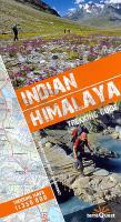
Indian Himalaya - Trekking guide + Trekkingmaps 1:350.000 Reiseführer (englisch) von Katarzyna und Andrzej Mazurkiewiczowie terraQuest ExpressMap
EAN / ISBN: 9788361155195
Preis: EUR 29.80
|
|


