Willkommen bei MapFox
Wurde Ihre Bestellung bestätigt? Wenn nicht - gab es evtl. ein SERVER-Problem! Bitte kontaktieren Sie uns! +++ Buchhändler-Anfragen erwünscht +++
Warenkorb
Artikel: 0 - € 0.00
Zur Kasse
Impressum Kontakt Versandkosten AGB
Skiing the Balkans Dimitar Dimitrov Bulgarien
<< Bulgarien
<< Iskartour Bulgarien
 
Cover

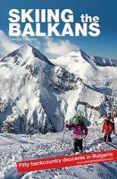
`Bulgaria? Is there actually any skiing in Bulgaria?!?`. No wonder such questions get asked. How can a small country in the south east end of Europe, roughly 400km long by 250km wide, bordering Mediterranean neighbors such as Greece and Turkey and famous for roses, wine and sandy beaches, be a ski destination, let alone a proper backcountry and freeriding one?

​ The reality is that the Balkan peninsula, located roughly between latitudes 36N and 47N, is a very mountainous region with multiple ranges rising more than 2000m above sea level. With some really well-preserved and even wild nature, and certain climate specifics in place, these mountains are suitable for good off-piste skiing for almost five months a year. And when storms line up one after another and deliver powder for days, 600-1200m steep descents turn into the norm, and you spend the evenings on your own at some remote backcountry hut with no cell coverage, you will see that Bulgaria and the Balkans are a hidden skiing gem.

"Skiing the Balkans" has 256 pages, 148 images and 41 maps. Take the practical information provided in this guidebook and come visit.

Kartenbeispiel

Skiing the Balkans Dimitar Dimitrov Bulgarien
EAN / ISBN: 9786199080900
Preis: EUR 22.90

Bestellartikel: versandfertig in ca. 2 Wochen oder länger. Dieser Artikel wird speziell für Sie bestellt. Keine Rücknahme!
Produkt EUR Anzahl Bestellen
Skiing the Balkans Dimitar Dimitrov Bulgarien 22.90
Versandkostenfrei in Deutschland ab 30,- Bestellwert

incl. MwSt.

Stichworte, die bei der Suche nützlich sein könnten:
Rila-Gebirge Wintersportführer - Pirin-Gebirge Skiführer - Bulgarien Reiseführer - Balkan Wintersport - Rilagebirge - Rila-Gebirge - Pirin - Pirin-Gebirge - Piringebirge - Witoscha - Witoschagebirge - Witosha - Vitosha - Bulgarien Landkarte - Bulgarien Wanderkarten - Bulgarien Stadtpläne - Bulgarien - Iskartouren - Bulgarien Landkarten - Bulgarien Reiseführer - Bulgarien Stadtpläne - Bulgarien Wanderkarten

Zuletzt angesehene Artikel:

CoverSkiing the Balkans Dimitar Dimitrov Bulgarien

CoverObergermanischer-Raetischer Limes in Baden-Württemberg 1:50.000 - UNESCO-Weltkurturerbe Landesvermessungsamt Baden-Württemberg

CoverHooking Up - The Ultimate Big Wall and Aid Climbing Manual Kletterführer - Fabio Elli/Peter Zarbrok - Versante Sud
.

Cover2632 03 Alposjärvi Topographische Karte 1:20.000 (Maastokartta / Peruskartta / Grundkarta) Maanmittauslaitos / Lantmäteriverket Finnland - ProjektNord

CoverStaaten Europas POSTER 97 x 67 cm - Stiefel EUROCART 1:1.720.000

CoverEifel-Höhen-Route Rundtour um den Nationalpark Eifel. 1:50.000, 230 km, GPS-Tracks Download, Live-Update - Esterbauer

Cover2331 02 Iiruu Topographische Karte 1:20.000 (Maastokartta / Peruskartta / Grundkarta) Maanmittauslaitos / Lantmäteriverket Finnland - ProjektNord

CoverTschechien geografisch / politisch-administrativ laminierte Karte A3 - 1:1.5 Mio
Ceska republika obecné zemepisná mapa / mapa administrativniho delení - SHOCart - Tschechien

Cover4110 (NL 33-05-10) Eibiswald Topographische Wanderkarte 1:50.000 mit Wegmarkierungen - Österreich - Kartographie BEV - ProjektNord

CoverPrättigau (Blatt 3) 1:50.000 Topographische Skitourenkarte der Schweiz - SNOW TRAIL MAP

Cover3733 02 Aravaara Topographische Karte 1:20.000 (Maastokartta / Peruskartta / Grundkarta) Maanmittauslaitos / Lantmäteriverket Finnland - ProjektNord

Cover01 Dorset South & Purbeck Wanderkarte 1:50.000 Großbritannien AA Automobile Association / OS Ordnance Survey Großbritannien

Cover213T BASEL - Sundgau - Blaueberg - Gempen 1:50.000 Topographische Wanderkarte SAW der Schweiz - swisstopo

CoverBaedeker Reiseführer Malta, Gozo, Comino MAIRDUMONT

CoverNepal 1:500.000 Landkarte - ITMB International Travel Maps (engl.)

Cover3144 09 Kyrsyänjärvi Topographische Karte 1:20.000 (Maastokartta / Peruskartta / Grundkarta) Maanmittauslaitos / Lantmäteriverket Finnland - ProjektNord

CoverPuglia Straßenkarte Local 1:200.000 (Blatt 363) Michelin Italien

Noch kein Cover vorhandenN-33-84-A/B Brusy Amtliche topographische Landkarte Polen 1:50.000
N-33-84-A/B Brusy - Mapa Topograficzna Polski Glowny Geodeta Kraju

CoverBretagne Ost Straßenkarte Local 1:150.000 (Blatt 309) Michelin Frankreich

CoverLech-Radweg 1:50.000 von Steeg in Tirol nach Donauwörth - Verlag Esterbauer