 Blattübersicht der ANAVASI-Karten:  Griechenland Nord und Mitte Nord-Ãgäis Griechenland Nord und Mitte Nord-Ãgäis
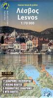
Peloponnes Ãgäis Kreta Lesvos is a gifted island in every respect. The whole island is UNESCO Global Geopark due to its many interesting geological features. The most impressive feature is the fossilized tree trunks due to the past intense volcanic activity. Lesvos is also one of the best locations in Europe to see migrating birds. In Lesvos there are important archaeological monuments, impressive medieval castles, Byzantine monasteries, traditional villages and a rich architectural heritage. 17 suggested walking routes and 6 ΜΤΒ routes are marked on the map. Kartenbeispiel
|
Lesbos (Blatt 10.53) 1:70.000 + Detailkarten Mytilini und Mithymna (Molyvos) - Petra 1:30.000 - 17 Wanderrouten - 6 MTB-Touren Topografische Wanderkarte griechische Inseln - Ãgäis - Anavasi - Griechenland
EAN / ISBN: 9786185823030
Preis: EUR 9.90
|
| 


