| << Rumänien: Wanderkarten von Zenith |
||
|
||
Zuletzt angesehene Artikel:
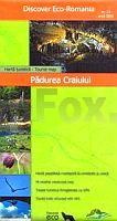
 | Pădurea Craiului 1:45.000 (Blatt 13) Touristische Wanderkarte - Bergwanderkarte Harta turistica / Tourist map Padurea Craiului - Adrian Patrulescu Zenith - Rumänien |
 | S432 Simo Topographische Karte 1:50.000 EUREF-FIN (Maastokarttat) Maanmittauslaitos / Lantmäteriverket Finnland - ProjektNord |
 | 50F TILBURG Topographische Karte der Niederlande 1:25.000 (Plotausgabe) 50F TILBURG Topografische Kaart van Nederland Kadaster - ProjektNord |
 | 0900 LA CARDENCHOSA Topographische Landkarte 1:50.000 Spanien (Grundlage MTN50) Instituto Geográfico Nacional - CNIG Spanien - ProjektNord |
 | G08 Langenzenn mit Cadolzburg - Dietenhofen - Emskirchen - RoÃtal - Veitsbronn - Wilhermsdorf ATK25 Topographische Karte 1:25.000 (Atkis) Bayern Landesvermessungsamt Bayern - Wanderkarte |
 | W226 Pforzheim - 1:25.000 Oberes Enztal, Bad Wildbad - Wanderkarte - Landesamt für Geoinformation und Landentwicklung Baden-Württemberg (LGL) |
 | 0183 ANDORRA LA VELLA Topographische Landkarte 1:50.000 Spanien (Grundlage MTN50) Instituto Geográfico Nacional - CNIG Spanien - ProjektNord |
 | 1930 Scharbeutz - Gestern und Heute - Historische Ãberlagerung 1932-1950 Topographische Landkarte 1:25.000 im Vergleich - Landesvermessungsamt Schleswig-Holstein / ProjektNord |
 | Thermenregion Baden - Forchtenstein - Rosaliengebirge - Buckelige Welt - Wiener Neustadt 1:50.000 (WK 023) - Wanderkarte / Radwanderkarte Ãsterreich - GPS - Freytag & Berndt |
 | Mit dem Wohnmobil nach Süd-Italien (Band 36) Teil 2: Der Westen - Tyrrhenisches Meer, Kampanien, Kalabrien, Ionisches Meer. Die Anleitung für einen Erlebnisurlaub. Tipps, Tricks, Touren, Tolle Strände. Alle Plätze mit präzisen GPS-Daten - von Reinhard Schulz und Waltraud Roth-Schulz - Womo-Verlag |
 | 0487-3 LEDANCA Topographische Landkarte 1:25.000 Spanien (Grundlage MTN25) Instituto Geográfico Nacional - CNIG Spanien - ProjektNord |
 | Seine Unterlauf - von Le Havre nach Paris (N° 1) Schifffahrtsführer Frankreich - von Philippe DEVISME & Patrick JOIN-LAMBERT LA SEINE AVAL - Du Havre Paris Fluviacarte Frankreich |
 | 2112-I-Nà Sønder Hygum Topographische Karte Dänemark 1:25.000 Topografisk kort Danmark (DTK/Kort25) 2112-I-Nà ProjektNord - Kort & Matrikelstyrelsen / Geodætisk Institut |
 | M-33-7-A/B Swidnica Amtliche topographische Landkarte Polen 1:50.000 M-33-7-A/B Swidnica - Mapa Topograficzna Polski Glowny Geodeta Kraju |
 | Umgebung Oppeln (Südteil) Touristenkarte Polen 1:40.000 Okolice Opola - czesc poludniowa PLAN Galileos - Polen |
 | 0629 TOLEDO Topographische Landkarte 1:50.000 Spanien (Grundlage MTN50) Instituto Geográfico Nacional - CNIG Spanien - ProjektNord |
 | 41A VARSSEVELD Topographische Karte der Niederlande 1:25.000 41A Varsseveld Topografische Kaart van Nederland Kadaster |
 | 0743-4 ABENGIBRE Topographische Landkarte 1:25.000 Spanien (Grundlage MTN25) Instituto Geográfico Nacional - CNIG Spanien - ProjektNord |
 | 0892-1 BARINAS Topographische Landkarte 1:25.000 Spanien (Grundlage MTN25) Instituto Geográfico Nacional - CNIG Spanien - ProjektNord |
 | Omalo - Pass Abano - Mt. Diklosmta Trekkingkarte Georgien 1:50.000 (Blatt 1) Geoland Maps Omalo - Pass Abano - Mt. Diklosmta 1:50.000 |