| << Russland: Städte, Stadtpläne, Stadtatlanten, Stadtführer << Karta LTD Sankt-Petersburg |
||
|
||

Zuletzt angesehene Artikel:
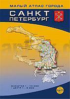
 | Kleiner Autoatlas Sankt-Petersburg - Zentrum 1:8.000 - Stadt 1:14.000 Karta LTD Sankt Petersburg Sankt-Peterburg - Malyj atlas goroda |
 | Ossowjez Topographische Karte 1:25.000 Messtischblatt des Deutschen Reiches - PreuÃische Landesaufnahme / Reichsamt für Landesaufnahme - Faksimile ProjektNord |
| 2186 Locken Topographische Karte 1:25.000 Messtischblatt des Deutschen Reiches - PreuÃische Landesaufnahme / Reichsamt für Landesaufnahme - Faksimile ProjektNord |
 | 1313 11 Rönnskären Topographische Karte 1:20.000 (Maastokartta / Peruskartta / Grundkarta) Maanmittauslaitos / Lantmäteriverket Finnland - ProjektNord |
| 3354 Tamsel Topographische Karte 1:25.000 Messtischblatt des Deutschen Reiches - PreuÃische Landesaufnahme / Reichsamt für Landesaufnahme - Faksimile ProjektNord |
 | Svenner - Porsgrunn - Jomfruland - Seekarte Norwegische Küste 1:50.000 - (Blatt 5) Den Norske Kyst 005 Sjøkart - Hovedkart (sjø) Statens Kartverk Sjø - Norwegen |
| 5765 Habelschwerdt Topographische Karte 1:25.000 Messtischblatt des Deutschen Reiches - PreuÃische Landesaufnahme / Reichsamt für Landesaufnahme - Faksimile ProjektNord |
| Zerwiny Topographische Karte 1:25.000 Messtischblatt des Deutschen Reiches - PreuÃische Landesaufnahme / Reichsamt für Landesaufnahme - Faksimile ProjektNord |
 | N544 Kiihtelysvaara Topographische Karte 1:50.000 EUREF-FIN (Maastokarttat) Maanmittauslaitos / Lantmäteriverket Finnland - ProjektNord |
| 4560 Armadebrunn Topographische Karte 1:25.000 Messtischblatt des Deutschen Reiches - PreuÃische Landesaufnahme / Reichsamt für Landesaufnahme - Faksimile ProjektNord |
 | Hardangervidda outdoor map - hiking - skiing - MTB - laminiert Touristische topographische Outdoorkarte Norwegen 1:150.000 - wasserfest - von Frank Brandl - Wanderkarte ProjektNord |
 | HAUTE LOIRE 4: Gorges de la Loire - Bassin du Puy-en-Velay - Massif Mézenc Meygal 1:50.000 Wanderkarte Culture & environnement / Kultur und Natur - IGN Frankreich |
 | 1096-3_4 ADEJE Topographische Landkarte 1:25.000 Spanien (Grundlage MTN25) Instituto Geográfico Nacional - CNIG Spanien - ProjektNord |
| Kazimierz Dolny - Landschaftsschutzpark Kazimierz Stadtplan 1:10.000 / Wanderkarte 1:45.000 Kazimierz Dolny - Kazimierski Park Krajobrazowy PLAN Galileos - Polen |
 | 870-1 RASPAY Amtliche topographische Landkarte 1:25.000 Spanien (M.T.N.) 870-1 Mapa Topográfico Nacional de Espana (MTN25) Instituto Geográfico Nacional - CNIG Spanien |
 | 252-4 ARAMUNT Amtliche topographische Landkarte 1:25.000 Spanien (M.T.N.) 252-4 Mapa Topográfico Nacional de Espana (MTN25) Instituto Geográfico Nacional - CNIG Spanien |
 | 5119 Kirchhain - Wanderkarte mit Wanderwegen (geplottete Ausgabe) Topographische Landkarte Hessen 1:25.000 - ProjektNord (geplottete Ausgabe) |
 | 4409 Herne (geplottete Ausgabe) Amtliche topographische Karte 1:25.000 Landesvermessungsamt Nordrhein-Westfalen |
 | L324 Uusikaupunki Topographische Karte 1:50.000 EUREF-FIN (Maastokarttat) Maanmittauslaitos / Lantmäteriverket Finnland - ProjektNord |
 | 26O HARDERWIJK (Oost) Topographische Karte der Niederlande 1:50.000 Topografische Dienst (Plotausgabe) |