| << Russland: Städte, Stadtpläne, Stadtatlanten, Stadtführer << Russland: Oblaste und Regionen etc. << Rus Co. Ltd. |
||
|
||
Zuletzt angesehene Artikel:
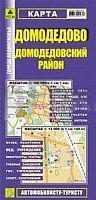
 | Domodedowo Stadtplan 1:14.000 / Region Domodedowo StraÃenkarte 1:100.000 StraÃenkarte - Russland Domodedovo - Domodedovskij Rajon Rus Co. Ltd. |
 | Das Tropenbuch - Vom Leben und Ãberleben in den Tropischen und Subtropischen Ländern Taschenbuch - Ronald Hanewald |
 | 1823 Todenbüttel Topographische Landkarte 1:25.000 Landesvermessungsamt Schleswig-Holstein |
 | 7 East Cape Topographische Landkarte Neuseeland 1:250.000 Land Information New Zealand |
 | Yorkshire Dales for cyclists - Radwanderkarte 1:100.000 wasserfest Yorkshire Dales Cycle Touring Map XT100 Harvey Maps - GroÃbritannien |
 | Vestfold - Fylkeskart 1:100.000 Topographische Landkarte Norwegen - UGLAND IT / Statens Kartverk / Nordeca |
 | 2844 Fürstenberg / Havel Topographische Karte 1:25.000 Landesvermessungsamt Brandenburg (gefaltet) |
 | R5411 Pyyvaara Topographische Karte 1:25.000 EUREF (Peruskartta) Maanmittauslaitos / Lantmäteriverket Finnland - ProjektNord |
 | 3115 Visbeck Topographische Wanderkarte 1:25.000 Niedersachsen mit Wanderwegen - ProjektNord |
 | Grenland Wanderkarte Norwegen 1:25.000 (Blatt 2435) - Nordeca / UGLAND / Statens Kartverk Norwegen |
| Oregon Bundesstaaten-StraÃenkarte 1:1.25 Mio. laminiert (Ohio - USA) Oregon state map laminated GM Johnson |
| L-34-VIII Kecskemét Amtliche Topographische Landkarte Ungarn 1:200.000 |
 | 6 Aneto Maladetas (Pirineo aragonés) - Wanderkarte 1:40.000 Prames - Spanien |
 | L-34-40-A Kecskemét Amtliche Topographische Karte Ungarn 1:50.000 |
 | 045 Val Martello - Silandro - Laces / Martelltal - Schlanders - Latsch Topographische Wanderkarte 1:25.000 - Casa Editrice Tabacco - Italien |
 | Gardasee / Lago di Garda /Monte Baldo 1:50.000 - Wanderkarte mit Broschüre (Blatt 102) KOMPASS |
 | 3852 Grunow Topographische Karte 1:25.000 Landesvermessungsamt Brandenburg (gefaltet) |
| L-33-34-A Szombathely Amtliche Topographische Karte Ungarn 1:50.000 |
 | Iceland`s Laugavegur trail - Fimmvörðuháls Trail - Two-way trekking map 1:40.000 Touristische Wanderkarte - Knife Edge Outdoor Guidebooks |
 | 2408 Greetsiel Topographische Wanderkarte 1:25.000 Niedersachsen mit Wanderwegen - ProjektNord |