| << Russland: Städte, Stadtpläne, Stadtatlanten, Stadtführer << Rus Co. Ltd. |
||
|
||
Zuletzt angesehene Artikel:
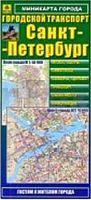
 | Sankt Petersburg - Öffentliche Verkehrsmittel Minikarte 1:50.000 / 1:25.000 Санкт-Петербург - Мини-карта Городской транспорт Rus Co. Ltd. |
 | L7528 Dillingen (geplottete Ausgabe) Topographische Karte Bayern 1:50.000 Bayerisches Landesvermessungsamt |
 | MTB Finale Ligure (Blatt MTB9) - Freeride Noli, Melogno Topographische Fahrradkarte 1:17.000 EdM - Edizioni del Magistero - Italien |
 | 3828 Lebenstedt Ost Amtliche topographische Karte 1:25.000 Landesvermessungsamt Niedersachsen |
 | Österreich: Jakobsweg von Wolfsthal nach Rankweil - von Lutz, Gerald - Stein, Conrad, Verlag |
 | C2714 Bremerhaven - Topographische Karte 1:100.000 Landesvermessungsamt Niedersachsen |
 | 4273 Sobotka Topographische Karte 1:25.000 Messtischblatt des Deutschen Reiches - Preußische Landesaufnahme / Reichsamt für Landesaufnahme - Faksimile ProjektNord |
 | Hochsauerland 1:35.000 Mountainbikekarte (wetterfest) 30 Mountainbiketouren, Tourenbeschreibungen mit Höhenprofil, Trail Park Winterberg und Trailground Brilon, UTM-Gitter - Nordrhein-Westfalen KKV - Kartographische Kommunale Verlagsgesellschaft |
| 4851 Bischofswerda Amtliche Topographische Landkarte 1:25.000 (Präsentationsgrafik) - Landesvermessungsamt Sachsen |
 | Jerusalem - City Pocket + The Big Five Laminierter Ministadtplan 1:12.500 Touristische Informationen, Stadtplan, Straßenverzeichnis - freytag & berndt |
 | Spanisch für Uruguay - Wort für Wort Kauderwelsch-Sprechführer (Band 189) Uruguay - Reise-Know-How Verlag |
 | Golestan Province (Blatt 499) 1:270.000 Landkarte Englisch und Persisch نقشه استان گلستان Gitashenasi - Iran |