 When you think of Hamburg, you think of the lively hustle and bustle of the harbour, the beautiful arcaded town hall, the charming canals in the Warehouse District and the attractive scenery along the Jungfernstieg. Then as now, Hamburg is considered the `gateway to the world?. Whereas European emigrants once departed for the New World, enormous cruise ships now dock in the harbour, taking on passengers with a love of travel. A wealth of attractions makes the Elbe metropolis one of the three main destinations in German city tourism. The tourist city map contains descriptions of important sights, an overview plan with a scale of 1 : 100.000, a city center map with a scale of 1 : 10.000 and a street index for fast orientation.
|
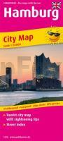
Hamburg Tourist City map with sightseeing tips and Street index. 1:18000 - von - Freytag-Berndt und ARTARIA PUBLICPRESS
EAN / ISBN: 9783961322220
Preis: EUR 9.90
|
|


