| << Finnland << Edition Elch |
  | |
Zuletzt angesehene Artikel:
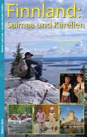
![]() | Finnland: Saimaa und Karelien Reiseführer Heiner Labonde u. Jessika Kuehn-Velten - Edition Elch |
![]() | Nationalpark Harz - Große Wander-, Ski- und Radwanderkarte 1:35.000 (Nr. 067) Ausflüge zum Brocken von Clausthal-Zellerfeld, Goslar, Wernigerode, Herzberg, Sankt Andreasberg und Schierke. Mit Harzer Hexenstieg. Große Wander-, Ski- und Radwanderkarte, GPS-fähig Dr. Barthel Verlag |
![]() | 51 - Topographische Landkarte Portugal 1:25.000 Carta Militar de Portugal - Série M889 Instituto Geográfico do Exército (IGeoE) - Portugal |
![]() | Engadin - Hikeline Wanderführer 1:35.000 Wandern in der Nationalparkregion Scuol - Samnaun - Val Müstair - 40 Touren - 485 km - GPS-Tracks Download. Wasserfest, reißfest - von Sabine Malecha und Joachim Lutz - Esterbauer |
![]() | 668 (29-26) Sagunto / Sagunt Amtliche topographische Landkarte 1:50.000 Spanien (M.T.N.) 668 Mapa Topográfico Nacional de Espana (MTN50) Instituto Geográfico Nacional - CNIG Spanien |
![]() | 25109 Säntis - Serie Gipfel 1:25.000 Schwägalp - Alpstein - Churfirsten - Topographische Wanderkarte der Schweiz - swisstopo |
![]() | NP110 Far-West (Himalaya) 1:150.000 Trekkingkarte Api & Saipal Himal - Khaptad & Rapa Nationalpark - Humla - (wasserfest) - Himalayan MapHouse Far-West 1:150.000 GHT (Great Himalayan Trail) trekking map (NP110) - (double-sided) - (weatherproof) - Himalayan MapHouse |
![]() | Westerwald mit Siebengebirge - 25 Touren über aussichtsreiche Höhen und durch idyllische Täler Wanderführer - von Ingrid Retterath - Conrad-Stein-Verlag |
![]() | 180-3 Castejón de Sos Amtliche topographische Landkarte 1:25.000 Spanien (M.T.N.) 180-3 Mapa Topográfico Nacional de Espana (MTN25) Instituto Geográfico Nacional - CNIG Spanien |
![]() | 142-3 MONREAL Amtliche topographische Landkarte 1:25.000 Spanien (M.T.N.) 142-3 Mapa Topográfico Nacional de Espana (MTN25) Instituto Geográfico Nacional - CNIG Spanien |
![]() | 50 Wanderrouten in Cotswolds Wanderführer - AA Automobile Association / OS Ordnance Survey - Großbritannien 50 walks in the Cotswolds - walking guide |
![]() | Kungsleden 3: Saltoluokta - Kvikkjokk 1:50.000 - Kungsleden Map and Guide Serie - wasserfest Norstedts - Schweden |
![]() | Sylan Nord Topographische Wanderkarte Topo 3000 - 1:50.000 (Blatt 3025) - Nordeca - Norwegen |
![]() | San Sebastián & Bilbao Reiseführer 100% authentisch, aktuell und vor Ort recherchiert. Inkl. App - von Sparrer, Petra - Michael Müller Verlag |
![]() | 112.4 Amtliche topographische Karte 1:50.000 Polen |
![]() | W255 Dietenheim - Wanderkarte 1:25.000 Illerkirchberg - Erolzheim - Schwäbischer Albverein |
![]() | 18 München Süd - Mittenwald, Bad Tölz, Kufstein - 1:100.000 Wanderkarte, Radkarte (ATK100) Landesamt für Vermessung und Geoinformation Bayern |
![]() | Touristischer Autoatlas Slowakei 1:100.000 (spiral.) Turisticky Autoatlas Slovensko spiralá Freytag & Berndt |
![]() | 115-4 ANSOAIN/ANTSOAIN Amtliche topographische Landkarte 1:25.000 Spanien (M.T.N.) 115-4 Mapa Topográfico Nacional de Espana (MTN25) Instituto Geográfico Nacional - CNIG Spanien |
![]() | 525-1 FUENTES DE OÑORO Amtliche topographische Landkarte 1:25.000 Spanien (M.T.N.) 525-1 Mapa Topográfico Nacional de Espana (MTN25) Instituto Geográfico Nacional - CNIG Spanien |


