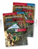
| << Rheinland-Pfalz - Saarland: Wanderführer << Nordrhein-Westfalen: Wanderführer << ideemedia << Eifel |
  | |
Zuletzt angesehene Artikel:
![]() | Wanderparadies Ahrsteig. - Start-Set Buch & Karte 1:25.000. Auf neuen Wegen durch das Rotweinparadies. 14 traumhafte Touren auf AhrSteig, Rotweinwanderweg, Dörferblick-Schleife und durch das Sahrbachtal ideemedia Idee media |
![]() | 3 GreenVelo: Woiwodschaft Podlachien (Nordteil) 1:100.000 Radwanderkarte der Radwege Nie tylko GreenVelo - mapa tras rowerowych - Wojewodstwo Podlaskie czesc polnocna Europilot - Daunpol - Polen |
![]() | M-34-31-A/B Skaryszew Amtliche topographische Landkarte Polen 1:50.000 M-34-31-A/B Skaryszew - Mapa Topograficzna Polski Glowny Geodeta Kraju |
![]() | Reisen in Botswana Botswana komplett mit allen Nationalparks, interessanten Allradstrecken und wertvollen GPS-Daten - von Ilona Hupe und Manfred Vachal - Ilona Hupe Verlag |
![]() | Rund um das Frische Haff - 1:100.000 Landkarte vom Bereich Königsberg / Kaliningrad bis Elbing / Elblag - Braunsberg / Braniewo bis Bartenstein / Bartoszyce - Ortsnamenkarte von Dirk Bloch - BLOCHPLAN |
![]() | M-34-30-C/D Skarzysko Kamienna Amtliche topographische Landkarte Polen 1:50.000 M-34-30-C/D Skarzysko Kamienna - Mapa Topograficzna Polski Glowny Geodeta Kraju |
![]() | Jastrzebie Zdrój - Zory - Pszczyna 1:20.000 Landkarte Jastrzębie Zdrój, Żory, Pszczyna Mapa / Plan miasta Daunpol - Polen |
![]() | M-34-37-A/B Kluczbork Amtliche topographische Landkarte Polen 1:50.000 M-34-37-A/B Kluczbork - Mapa Topograficzna Polski Glowny Geodeta Kraju |
![]() | M-33-46-C/D Dzierzoniow Amtliche topographische Landkarte Polen 1:50.000 M-33-46-C/D Dzierzoniow - Mapa Topograficzna Polski Glowny Geodeta Kraju |
![]() | CC 3150 Schwedt (Oder) Topographische Übersichtskarte 1:200.000 - Bundesamt für Kartografie und Geodäsie und Landesvermessungsämter - ProjektNord |
![]() | Oppeln (Woiwodschaft) 1:150.000 Straßenkarte / Administrative Karte MAPA SKLADANA WOJEWODZTWA OPOLSKIEGO - ADMINSTRACYJNO-SAMOCHODWA Wydawnictwo Pietka - Polen |
![]() | M-34-28-A/B Gorzkowice Amtliche topographische Landkarte Polen 1:50.000 M-34-28-A/B Gorzkowice - Mapa Topograficzna Polski Glowny Geodeta Kraju |
![]() | 1224 Sörup - Gestern und Heute - Historische Überlagerung 1953-1956 Topographische Landkarte 1:25.000 im Vergleich - Landesvermessungsamt Schleswig-Holstein / ProjektNord |
![]() | CC 1518 Flensburg Topographische Übersichtskarte 1:200.000 - Bundesamt für Kartografie und Geodäsie und Landesvermessungsämter - ProjektNord |
![]() | M-34-102-A/B Lubowola Amtliche topographische Landkarte Polen 1:50.000 M-34-102-A/B Lubowola - Mapa Topograficzna Polski Glowny Geodeta Kraju |
![]() | P11 Wolfratshausen - Geretsried - Icking - Egling - Dietramszell - Königsdorf - Sauerlach *** SCHNÄPPCHEN *** ATK25 Topographische Karte 1:25.000 (Atkis) Bayern Landesvermessungsamt Bayern - Wanderkarte |
![]() | Glatzer Bergland - Singletrack Glacensis - Fahrradkarte 1:95.000 Fahrradkarte Ziemia Kłodzka Singletrack Glacensis mapa tras rowerowych (wyd. pap.) PLAN Galileos - Polen |
![]() | 24-133 Křižanov (Krizanov) Topographische Karte 1:25.000 der Tschechischen Republik Zakladní mapa Ceská republika - Cesky urad zememericky a katastralni - ProjektNord |
![]() | Die Berge Pokutiens 1:50.000 Topografische Wanderkarte 1:50.000 Karpaten - Ukraine Pokutski Mountains / Pokutski Hory - paperova mapa ASSA / Karpatski Steszky - Ukraine |
![]() | Q13 Bayrischzell - Bad Feilnbach, Raubling, Fischbachau, Brannenburg, Wendelstein, Spitzingsee ATK25 Topographische Karte 1:25.000 (Atkis) Bayern Landesvermessungsamt Bayern - Wanderkarte - Radwanderkarte |


