| << Deutschland: Historische Karten und Stadtpläne (im Bereich der heutigen Bundesrepublik) << Rockstuhl |
||
|
||

Zuletzt angesehene Artikel:
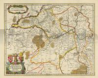
 | Das Fürstentum Anhalt und das Erzbistum Magdeburg 1647 - Historische Landkarte Nachdruck Planokarte - gerollt von Janssonius, Joh. - Verlag Rockstuhl |
 | Fars Province & Shiraz City (Blatt 364) 1:1.1 Mio. Landkarte Persisch نقشه استان فارس و شهر شيراز Gitashenasi - Iran |
 | 0852 VILLANUEVA DEL FRESNO Topographische Landkarte 1:50.000 Spanien (Grundlage MTN50) Instituto Geográfico Nacional - CNIG Spanien - ProjektNord |
 | 367-4 SALTO DE CASTRO Amtliche topographische Landkarte 1:25.000 Spanien (M.T.N.) 367-4 Mapa Topográfico Nacional de Espana (MTN25) Instituto Geográfico Nacional - CNIG Spanien |
 | 60 Balmaseda Amtliche topographische Landkarte 1:50.000 Spanien (M.T.N.) 60 Mapa Topográfico Nacional de Espana (MTN50) Instituto Geográfico Nacional - CNIG Spanien |
 | 2134 10 Hollolan Topographische Karte 1:20.000 (Maastokartta / Peruskartta / Grundkarta) Maanmittauslaitos / Lantmäteriverket Finnland - ProjektNord |
 | Lorestan - Touristische Landkarte - Provinz-StraÃenkarte 1:300.000 (Blatt 191) Landkarte / StraÃenkarte (englisch) The Tourism Map of Lorestan - لرستان Iranshenasi - Iran |
 | 22-3 (11-08) PONTEDEUME Amtliche topographische Landkarte 1:25.000 Spanien (M.T.N.) 22-3 Mapa Topográfico Nacional de Espana (MTN25) Instituto Geográfico Nacional - CNIG Spanien |
 | 723 (38-28) Isla del Toro y Cap de Cala Figuera - Mallorca Amtliche topographische Landkarte 1:50.000 Spanien (M.T.N.) 723 Mapa Topográfico Nacional de Espana (MTN50) Instituto Geográfico Nacional - CNIG Spanien |
 | 739-1 ARENALES DE SAN GREGORIO Amtliche topographische Landkarte 1:25.000 Spanien (M.T.N.) 739-1 Mapa Topográfico Nacional de Espana (MTN25) Instituto Geográfico Nacional - CNIG Spanien |
 | 562-4 VILLALBA DEL REY Amtliche topographische Landkarte 1:25.000 Spanien (M.T.N.) 562-4 Mapa Topográfico Nacional de Espana (MTN25) Instituto Geográfico Nacional - CNIG Spanien |
| 2378 Neuenburg in WestpreuÃen Topographische Karte 1:25.000 Messtischblatt des Deutschen Reiches - PreuÃische Landesaufnahme / Reichsamt für Landesaufnahme - Faksimile ProjektNord |
 | 3233 04 Paatela Topographische Karte 1:20.000 (Maastokartta / Peruskartta / Grundkarta) Maanmittauslaitos / Lantmäteriverket Finnland - ProjektNord |
 | 167-3 HUERMECES Amtliche topographische Landkarte 1:25.000 Spanien (M.T.N.) 167-3 Mapa Topográfico Nacional de Espana (MTN25) Instituto Geográfico Nacional - CNIG Spanien |
| Erläuterungen zur Geologischen Karte 5442 Aue - Ausgabe 2009 Sächsisches Landesamt für Umwelt, Landwirtschaft und Geologie |
 | 948 Bedmar Amtliche topographische Landkarte 1:50.000 Spanien (M.T.N.) 948 Mapa Topográfico Nacional de Espana (MTN50) Instituto Geográfico Nacional - CNIG Spanien |
 | 0896-2 SEGURA DE LEÃN Topographische Landkarte 1:25.000 Spanien (Grundlage MTN25) Instituto Geográfico Nacional - CNIG Spanien - ProjektNord |
 | 369-4 CORESES Amtliche topographische Landkarte 1:25.000 Spanien (M.T.N.) 369-4 Mapa Topográfico Nacional de Espana (MTN25) Instituto Geográfico Nacional - CNIG Spanien |
 | 391-I Odena Amtliche topographische Landkarte 1:25.000 Spanien (M.T.N.) 391-I Mapa Topográfico Nacional de Espana (MTN25) Instituto Geográfico Nacional - CNIG Spanien |
 | 7834 München-Pasing Topographische Landkarte Bayern 1:25.000 - Normalausgabe - ProjektNord (geplottete Ausgabe) - Grundlage amtliche Topographische Karte Bayern DTK25 |