| << Deutschland: Historische Karten und Stadtpläne (im Bereich der heutigen Bundesrepublik) << Rockstuhl |
||
|
||

Zuletzt angesehene Artikel:
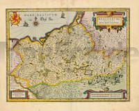
 | Herzogtum Mecklenburg 1647 - Historische Landkarte Nachdruck Planokarte - gerollt von Janssonius, Joh. - Verlag Rockstuhl |
 | 2143 10 Kelvenne Topographische Karte 1:20.000 (Maastokartta / Peruskartta / Grundkarta) Maanmittauslaitos / Lantmäteriverket Finnland - ProjektNord |
 | 0712-1 ESTACIÃN DE URDA PELECHES Topographische Landkarte 1:25.000 Spanien (Grundlage MTN25) Instituto Geográfico Nacional - CNIG Spanien - ProjektNord |
 | 2662 Märkisch Friedland Topographische Karte 1:25.000 Messtischblatt des Deutschen Reiches - PreuÃische Landesaufnahme / Reichsamt für Landesaufnahme - Faksimile ProjektNord |
 | 4321 09 Valtimo Topographische Karte 1:20.000 (Maastokartta / Peruskartta / Grundkarta) Maanmittauslaitos / Lantmäteriverket Finnland - ProjektNord |
 | 2321 05 SUNDBY Topographische Karte 1:20.000 (Maastokartta / Peruskartta / Grundkarta) Maanmittauslaitos / Lantmäteriverket Finnland - ProjektNord |
| Taujenai (65-69/45-49) Topografische Karte Litauen 1:50.000 Lietuvos Respublikos Topografinis Zemelapis 1:50.000 - Nacionaline Zemes Tarnyba - Litauen |
 | 1824 07 ISO-MALLA Topographische Karte 1:20.000 (Maastokartta / Peruskartta / Grundkarta) Maanmittauslaitos / Lantmäteriverket Finnland - ProjektNord |
 | 710-2 EL MOLINILLO Amtliche topographische Landkarte 1:25.000 Spanien (M.T.N.) 710-2 Mapa Topográfico Nacional de Espana (MTN25) Instituto Geográfico Nacional - CNIG Spanien |
 | 2041 01 Lohja Topographische Karte 1:20.000 (Maastokartta / Peruskartta / Grundkarta) Maanmittauslaitos / Lantmäteriverket Finnland - ProjektNord |
 | 4323 06 Lusikkakangas Topographische Karte 1:20.000 (Maastokartta / Peruskartta / Grundkarta) Maanmittauslaitos / Lantmäteriverket Finnland - ProjektNord |
 | 3023 03 Tesjoki Topographische Karte 1:20.000 (Maastokartta / Peruskartta / Grundkarta) Maanmittauslaitos / Lantmäteriverket Finnland - ProjektNord |
| Erläuterungen zur Geologischen Karte 4547 Elsterwerda - Ausgabe 1927 Sächsisches Landesamt für Umwelt, Landwirtschaft und Geologie |
 | Sauerland Höhenflug, Meinerzhagen / Altena - Korbach Leporello Wanderkarte mit Ausflugszielen, Einkehr- & Freizeittipps, wetterfest, reissfest, abwischbar, GPS-genau. 1:25000 - von - Freytag-Berndt und ARTARIA Publicpress |
 | 3444 06 Kempasvaara Topographische Karte 1:20.000 (Maastokartta / Peruskartta / Grundkarta) Maanmittauslaitos / Lantmäteriverket Finnland - ProjektNord |
 | 4311 08 Halivaara Topographische Karte 1:20.000 (Maastokartta / Peruskartta / Grundkarta) Maanmittauslaitos / Lantmäteriverket Finnland - ProjektNord |
 | 3134 01 Lemi Topographische Karte 1:20.000 (Maastokartta / Peruskartta / Grundkarta) Maanmittauslaitos / Lantmäteriverket Finnland - ProjektNord |
 | 4404 Issum - Wanderkarte mit Wanderwegen (geplottete Ausgabe) ProjektNord - Grundlage Amtliche topographische Karte 1:25.000 Landesvermessungsamt Nordrhein-Westfalen |
 | 165-2 HERRERA DE PISUERGA Amtliche topographische Landkarte 1:25.000 Spanien (M.T.N.) 165-2 Mapa Topográfico Nacional de Espana (MTN25) Instituto Geográfico Nacional - CNIG Spanien |
 | 39C GELDERMALSEN Topographische Karte der Niederlande 1:25.000 (Plotausgabe) 39C GELDERMALSEN Topografische Kaart van Nederland Kadaster - ProjektNord |