| << Deutschland: Historische Karten und Stadtpläne (im Bereich der heutigen Bundesrepublik) << Rockstuhl |
||
|
||

Zuletzt angesehene Artikel:
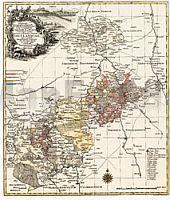
 | Der Vogtlandkreis 1757 - Historische Landkarte Nachdruck Planokarte - gerollt von Lotter - Verlag Rockstuhl |
 | 0468-2 PUIG MORENO Topographische Landkarte 1:25.000 Spanien (Grundlage MTN25) Instituto Geográfico Nacional - CNIG Spanien - ProjektNord |
 | 0288-1 EL GRADO Topographische Landkarte 1:25.000 Spanien (Grundlage MTN25) Instituto Geográfico Nacional - CNIG Spanien - ProjektNord |
 | 0831-2 ZALAMEA DE LA SERENA Topographische Landkarte 1:25.000 Spanien (Grundlage MTN25) Instituto Geográfico Nacional - CNIG Spanien - ProjektNord |
 | 1022-4 CAMPILLOS Amtliche topographische Landkarte 1:25.000 Spanien (M.T.N.) 1022-4 Mapa Topográfico Nacional de Espana (MTN25) Instituto Geográfico Nacional - CNIG Spanien |
 | 0709-1 ANCHURAS Topographische Landkarte 1:25.000 Spanien (Grundlage MTN25) Instituto Geográfico Nacional - CNIG Spanien - ProjektNord |
 | 5121 Großvenediger - Nationalpark Hohe Tauern - Krimml - Mittersill 1:35.000 - Wanderkarte / Radwanderkarte / Wintersportkarte Österreich - GPS - Freytag & Berndt |
 | 1049-1 BORNOS Amtliche topographische Landkarte 1:25.000 Spanien (M.T.N.) 1049-1 Mapa Topográfico Nacional de Espana (MTN25) Instituto Geográfico Nacional - CNIG Spanien |
 | 1046 CARBONERAS Topographische Landkarte 1:50.000 Spanien (Grundlage MTN50) Instituto Geográfico Nacional - CNIG Spanien - ProjektNord |