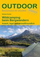
| << Conrad-Stein-Verlag |
  | |
Zuletzt angesehene Artikel:
![]() | Wildcamping beim Bergwandern - von Nostitz, Raffaele - Stein, Conrad, Verlag |
![]() | Warsaw Pocket Guide Reiseführer Lonely Planet (engl.) |
![]() | Afrika West 1:3.4 Mio. Landkarte - ITMB International Travel Reference Maps (engl.) Africa western |
![]() | Walking Ben Lawers, Rannoch and Atholl - Mountains and glens of Highland Perthshire Wanderführer Schottland - Cicerone Großbritannien (englisch) |
![]() | Welt politisch Decorative Laminierte PLANO-Karte 1:36.3 Mio. (Format: 108 x 75 cm) - gerollt im Plastikrohr World political flat map decorative - laminated National Geographic |
![]() | Weltkarte politisch POSTER gefaltet World Political Wall Map Periplus Editors |
![]() | 0494 Wilkieten Topographische Karte 1:25.000 Messtischblatt des Deutschen Reiches - Preußische Landesaufnahme / Reichsamt für Landesaufnahme - Faksimile ProjektNord |
![]() | M-34-48-A/B Wojslawice Amtliche topographische Landkarte Polen 1:50.000 M-34-48-A/B Wojslawice - Mapa Topograficzna Polski Glowny Geodeta Kraju |
![]() | Wnory Topographische Karte 1:25.000 Messtischblatt des Deutschen Reiches - Preußische Landesaufnahme / Reichsamt für Landesaufnahme - Faksimile ProjektNord |
![]() | Welt politisch Decorative - große Ausgabe PLANO-Karte 1:20.977 Mio. (Format: 186 x 122 cm) - gerollt im Plastikrohr World political flat map enlarged decorative National Geographic |
![]() | Westindische Inseln Laminierte PLANO-Karte 1:3.2 Mio. (Format: 91 x 59 cm) - gerollt im Plastikrohr West Indies Traveller flat map - laminated National Geographic |
![]() | Welt Executive politisch - 3 Karten PLANO-Karte 1:14.22 Mio. (Format: 296 x 193 cm) - gerollt im Plastikrohr World political flat map 3-sheets executive National Geographic |
![]() | M-34-25-A/B Wieruszow Amtliche topographische Landkarte Polen 1:50.000 M-34-25-A/B Wieruszow - Mapa Topograficzna Polski Glowny Geodeta Kraju |
![]() | Wielun Topographische Karte 1:25.000 Messtischblatt des Deutschen Reiches - Preußische Landesaufnahme / Reichsamt für Landesaufnahme - Faksimile ProjektNord |
![]() | Welt Executive politisch - große Ausgabe PLANO-Karte 1:22.44 Mio. (Format: 185 x 122 cm) - gerollt im Plastikrohr World political flat map enlarged executive National Geographic |


