| << Übersichtskarte Bundesrepublik Deutschland 1:200.000 / 1:250.000 - Bundesamt für Kartographie und Geodäsie / ProjektNord << Deutschland 1:200.000 von ProjektNord - Kartographie: Bundesamt für Kartographie und Geodäsie |
  | |
|
||
Zuletzt angesehene Artikel:
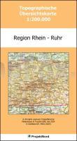
![]() | Region Rhein - Ruhr 1:200.000 Topographische Straßenkarte ProjektNord - Bundesamt f. Kartographie u. Geodäsie |
![]() | Costa Etrusca - Da Cecina A San Vincenzo 1:25.000 (Blatt 539) Carta Turistica E Dei Sentieri - Edizioni Multigraphic - Italien |
![]() | 2215-I Hammershøj Topographische Karte Dänemark 1:50.000 - Kort & Matrikelstyrelsen ProjektNord |
![]() | Deine bunte Erde Erlebniskarte mit Metall-Beleistung - Krüger & Schönhoff - K & S druckbunt Verlag |
![]() | 132.2 Amtliche topographische Karte 1:50.000 Polen |
![]() | 15-3 Topographische Karte 1:100.000 der Tschechischen Republik Zakladnà mapa Ceská republika - Cesky urad zememericky a katastralni - ProjektNord |
![]() | 153.34 Amtliche topographische Karte 1:25.000 Polen |
![]() | Provence - West walking in Drôme Provençal, Vaucluse, Var Wanderführer - Cicerone (englisch) |
![]() | 43 Strömstad 1:50.000 (wasserfest) *** SCHNÄPPCHEN *** Topographische Wanderkarte - Sverigeserien Topo50 - Schweden Norstedts |
![]() | 1933 Großklützhöved *** SCHNÄPPCHEN *** Amtliche Topographische Karte 1:25.000 Landesvermessungsamt Mecklenburg-Vorpommern |
![]() | 175.2 Amtliche topographische Karte 1:50.000 Polen |
![]() | 156 Saxmundham - Aldeburgh & Southwold - Wanderkarte Großbritannien 1:50.000 LANDRANGER MAP - Ordnance Survey |
![]() | 120 S Snåsa SØR 1:50.000 - Amtliche Topographische Landkarte Norwegen - Startens Kartverk |
![]() | 132.3 Amtliche topographische Karte 1:50.000 Polen |
![]() | 136.43 Amtliche topographische Karte 1:25.000 Polen |
![]() | 183.4 Amtliche topographische Karte 1:50.000 Polen |
![]() | 18B WESSINGTANGE Topographische Karte der Niederlande 1:25.000 (Plotausgabe) 18B WESSINGTANGE Topografische Kaart van Nederland Kadaster - ProjektNord |
![]() | 124.14 Amtliche topographische Karte 1:25.000 Polen |
![]() | 11 Haarlem Topographische Karte der Niederlande 1:100.000 (Plotausgabe) kadaster - Topografische Dienst / ProjektNord |


