| << Radwanderkarten bikeline - Esterbauer |
  | |
|
||
Zuletzt angesehene Artikel:
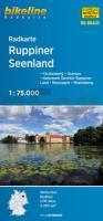
![]() | Ruppiner Seenland 1:75.000 (Blatt RK-BRA05) Neuruppin - Wittstock - Neustadt/Dosse - Fürstenberg, Ostprignitz-Ruppin - Oberhavel - Müritz - bikeline-Radkarte 1:75.000 Deutschland Esterbauer |
![]() | 3411SB Thionville - Sierck-les-Bains GPS Amtliche Topographische Wanderkarte Frankreich 1:25.000 - série bleue (IGN) |
![]() | 4049-NO Topographische Karte 1:10.000 - Landesvermessungsamt Brandenburg |
![]() | Lahn-Camino und Rhein-Camino Wanderführer - von Wolfgang Scholz - Conrad Stein Verlag GmbH |
![]() | Lanzarote - Die schönsten Küsten- und Vulkanwanderungen - Rother Wanderführer - Bergverlag Rother |
![]() | L3142 Brandö Topographische Karte 1:25.000 EUREF (Peruskartta) Maanmittauslaitos / Lantmäteriverket Finnland - ProjektNord |
![]() | 2114-IV-SV Topographische Karte Dänemark 1:25.000 Topografisk kort Danmark (DTK/Kort25) 2114-IV-SV ProjektNord - Kort & Matrikelstyrelsen / Geodætisk Institut |
![]() | 4121 12 Särkilahti Topographische Karte 1:20.000 (Maastokartta / Peruskartta / Grundkarta) Maanmittauslaitos / Lantmäteriverket Finnland - ProjektNord |
![]() | KOMPASS Fahrradkarte 3324 Aachen, Dreiländereck, Eifel, Hohes Venn mit Knotenpunkten 1:70.000 reiß- und wetterfest mit Extra Stadtplänen - von - KOMPASS-Karten |
![]() | 192 S Grense Jakobselv SØR 1:50.000 - Amtliche Topographische Landkarte Norwegen - Startens Kartverk |
![]() | 3752-NW Topographische Karte 1:10.000 - Landesvermessungsamt Brandenburg |
![]() | L3134 Korpo Topographische Karte 1:25.000 EUREF (Peruskartta) Maanmittauslaitos / Lantmäteriverket Finnland - ProjektNord |
![]() | 6208 Morscheid-Riedenburg - Wanderkarte mit Wanderwegen (geplottete Ausgabe) ProjektNord - Grundlage Amtliche topographische Karte Landesamt für Vermessung und Geobasisinformation Rheinland-Pfalz |
![]() | 1821 Albersdorf - Gestern und Heute - Historische Überlagerung 1953-1956 Topographische Landkarte 1:25.000 im Vergleich - Landesvermessungsamt Schleswig-Holstein / ProjektNord |
![]() | 532 - Topographische Landkarte Portugal 1:25.000 Carta Militar de Portugal - Série M889 Instituto Geográfico do Exército (IGeoE) - Portugal |
![]() | 6913 Oberotterbach Topographische Karte 1:25.000 - Landesamt für Vermessung und Geobasisinformation Rheinland-Pfalz |
![]() | 3221 12 Saarikas Topographische Karte 1:20.000 (Maastokartta / Peruskartta / Grundkarta) Maanmittauslaitos / Lantmäteriverket Finnland - ProjektNord |
![]() | 059 S Askvoll - Solund SØR 1:50.000 - Amtliche Topographische Landkarte Norwegen - Startens Kartverk |
![]() | 8024 Bad Waldsee Topographische Landkarte 1:25.000 - Landesvermessungsamt Baden-Württemberg |
![]() | 534 - Topographische Landkarte Portugal 1:25.000 Carta Militar de Portugal - Série M889 Instituto Geográfico do Exército (IGeoE) - Portugal |


