| << Großbritannien: Reiseführer << Baedeker-Reiseführer |
  | |
Zuletzt angesehene Artikel:
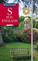
![]() | Baedeker Reiseführer Südengland von Maunder, Hilke u. Reincke Dr., Madeleine |
![]() | Altes und modernes Athen Stadtplan-Set 1:4.800 / 1:6.400 wasserfest - reißfest Ancient Athens: Topography - Monuments - Museums / Modern Athens: Architecture - Monuments - Museums - Cultural maps SET Anavasi - Griechenland |
![]() | Schottland 1:400.000 Landkarte world-mapping-project Reiß- und wasserfest - Reise Know-How Verlag |
![]() | Niederlande 1:200.000 mit Distoguide Straßenkarte Hallwag Verlag |
![]() | 06 Poole, Bournemouth & Purbeck Wanderkarte 1:25.000 Großbritannien AA Automobile Association / OS Ordnance Survey Großbritannien |
![]() | 3715ET Wasselonne - Brumat Topographische Wanderkarte Frankreich 1:25.000 TOP 25 IGN |
![]() | 54/5-6 LEIGNON NGI 1:25.000 Topographische Landkarte Belgien |
![]() | 451.3 Zgorzelec (Görlitz) Amtliche topographische Karte 1:50.000 Polen |
![]() | Cote d`Azur - Esterelmassiv Straßenkarte Zoom 1:100.000 (Blatt 115) Michelin |
![]() | Oakland County - South Stadtplan 1:41.000 (Michigan - USA) Oakland County - South street map American Automobile Association |


