| << Italienische Alpen-Wanderkarten / Skikarten - weitere Verlage << Hallwag |
  | |
Zuletzt angesehene Artikel:
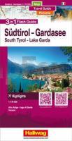
![]() | Südtirol - Gardasee - Venedig - Flash Guide 1:175.000 - Eine Strassenkarte mit Reiseführer und Fotos, also 3 in 1 - Hallwag |
![]() | 2245SB Castelnaudary - Bram GPS Amtliche Topographische Wanderkarte Frankreich 1:25.000 - série bleue (IGN) |
![]() | 4153-SO Topographische Karte 1:10.000 - Landesvermessungsamt Brandenburg |
![]() | C5910 Koblenz Topographische Landkarte 1:100.000 - Landesvermessungsamt Rheinland-Pfalz |
![]() | 6121 Heimbuchenthal Topographische Landkarte Bayern 1:25.000 - Normalausgabe - ProjektNord (geplottete Ausgabe) - Grundlage amtliche Topographische Karte Bayern DTK25 |
![]() | Mandinka (Gambia) - Wort für Wort Kauderwelsch-Sprachführer (Band 095) Reise-Know-How Verlag |
![]() | Tatopani (Annapurna-Region) Trekkingkarte 1:50.000 (NA515) Himalayan MapHouse - Nepal Treks around Pokhara - Tatopani (Hot Spring) Trek |
![]() | 8036 Otterfing Topographische Landkarte Bayern 1:25.000 - Normalausgabe - ProjektNord (geplottete Ausgabe) - Grundlage amtliche Topographische Karte Bayern DTK25 |
![]() | SETAU SAGÈTH Wanderkarte 1:30.000 - Editorial Piolet - Spanien |
![]() | 3049-SO Topographische Karte 1:10.000 - Landesvermessungsamt Brandenburg |
![]() | Back to Monschau 1:25.000 Touristische Landkarte und Wanderkarte, Radwanderkarte - Mini Ardenne |
![]() | 4452-SW Topographische Karte 1:10.000 - Landesvermessungsamt Brandenburg |
![]() | BP29 - Endeavour Inlet Topographische Landkarte Neuseeland 1:50.000 Land Information New Zealand |
![]() | Kronstadt Kreiskarte - Rumänien 1:250.000 BEL ALPIN TOUR SRL Brasov County Tourist Map, Central Romania 1:250.000 Carpathians, Transylvania |
![]() | Saarland - Luxemburg Rother Wanderführer - Bergverlag Rother |
![]() | 10 La Via dei Campioni 1:25.000 - Rifugio Cascina Foi - Lerma - Rad- und Wanderkarte - Ingenia Editori - Italien Carta cicloescursionistica del tratto compreso tra Rifugio Cascina Foi e Lerma sulla Via dei Campioni |
![]() | Westerwald mit Siebengebirge - 25 Touren über aussichtsreiche Höhen und durch idyllische Täler Wanderführer - von Ingrid Retterath - Conrad-Stein-Verlag |
![]() | 2403SB Bailleul - Steenvoorde GPS Amtliche Topographische Wanderkarte Frankreich 1:25.000 - série bleue (IGN) |
![]() | BD43 Topographische Landkarte Neuseeland 1:50.000 Land Information New Zealand |
![]() | Britain road map (aktuelle Jahresausgabe) HarperCollins |


