| << Chamina - Wanderführer (französischsprachig) |
  | |
Zuletzt angesehene Artikel:
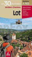
![]() | Lot - Les 30 plus beaux sentiers - Balades à pied Wanderführer - (französisch) Chamina - Frankreich |
![]() | Icelandic Bird Guide: Appearance, Way of Life, Habitat by Johann Oli Hilmarsson Mal og menning Island |
![]() | A Pilgrim`s Guide to the Camino Sanabrés & Camino Invierno by John Brierley Caminoguides - Findhorn Press |
![]() | 14 Kalabrien - Cosenza - Crotone - Réggio di Calabria Reisekarte Italien 1:200.000 - Kümmerly & Frey Calabria |
![]() | 119 Ägina (Egina) 1:25.000 Landkarte Griechische Inseln - Road Editions - Griechenland |
![]() | Estland Straßenatlas 1:100.000 (estnisch/englisch/finnisch/russisch) Eesti Teedeatlas REGIO Estland |
![]() | 379 Dunkeld - Aberfeldy & Glen Almond - Wanderkarte Großbritannien 1:25.000 EXPLORER MAP - Ordnance Survey |
![]() | 424 Buckie & Keith - Wanderkarte Großbritannien 1:25.000 *** SCHNÄPPCHEN *** EXPLORER MAP - Ordnance Survey |
![]() | OL13 Brecon Beacons National Park - Eastern area - Wanderkarte Großbritannien 1:25.000 NEW EXPLORER MAP - Ordnance Survey |
![]() | M-34-XXXIV Sátoraljaújhely Amtliche Topographische Landkarte Ungarn 1:200.000 |
![]() | Kamtschatka Zu den Bären und Vulkanen im Nordosten Sibiriens - Heßberg, Andreas von Trescher Verlag |
![]() | 448 Strath Naver / Srath Nabhair & Loch Loyal - Wanderkarte Großbritannien 1:25.000 EXPLORER MAP - Ordnance Survey |
![]() | 358 Lochgilphead & Knapdale North - Wanderkarte Großbritannien 1:25.000 EXPLORER MAP - Ordnance Survey |
![]() | Irkutsk - Baikalsk 1:200.000 Landkarte - Russland Irkutskaja Kartografitscheskaja Fabrika - VostSib AGP |
![]() | Tuscarawas County County-Straßenkarte 1:63.000 (Ohio - USA) Tuscarawas County county map GIS / Cartography & Publishing Services / GM Johnson |
![]() | 440 Glen Cassley & Glen Oykel - Wanderkarte Großbritannien 1:25.000 EXPLORER MAP - Ordnance Survey |
![]() | OL57 Cairn Gorm & Aviemore - Wanderkarte Großbritannien 1:25.000 EXPLORER MAP - Ordnance Survey |
![]() | OL3 Meon Valley - Portsmouth - Gosport & Fareham - Wanderkarte Großbritannien 1:25.000 EXPLORER MAP - Ordnance Survey |
![]() | OL14 Wye Valley and Forest of Dean - Wanderkarte Großbritannien 1:25.000 NEW EXPLORER MAP - Ordnance Survey |
![]() | OL18 Harlech - Porthmadog & Bala/Y Bala - Wanderkarte Großbritannien 1:25.000 NEW EXPLORER MAP - Ordnance Survey |


