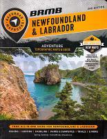
 Map Features: Highways, Logging Roads, Land & Water Features, Parks, Adventure Points of Interest, Campgrounds, Hiking Trails, Motorized Trails, Paddling Routes, Hunting & Fishing Areas, Winter Recreation and more Areas Covered: Bay Roberts, Carbonear, Clarenville-Shoal Harbour, Channel-Port aux Basques, Conception Bay, Corner Brook, Gander, Grand Falls-Windsor, Gros Morne, Happy Valley-Goose Bay, Labrador  Kartenausschnitt Kartenausschnitt
Kartenbeispiel
|
Newfoundland & Labrador Topo Map and Guide 1:250.000 / 1:1 Mio. Atlas
EAN / ISBN: 9781989175231
Preis: EUR 39.90
|
|


