Willkommen bei MapFox
+++ Buchhändleranfragen willkommen! Tel. 0431-666 75 99 +++
Warenkorb
Artikel: 0 - € 0.00
Zur Kasse
Impressum Kontakt Versandkosten AGB
Gunks Climbing Wolverine Publishing Llc
<< USA: Reiseführer, Reisehandbücher
 
Cover

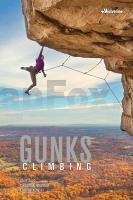
The Shawangunks - "the Gunks" to most of us - is one of the oldest climbing areas in the US, with a storied history dating back to the 1930s. Located 80 miles north of New York City, it has long been a focal point of rock-climbing culture, and remains a traditional climber?s paradise. There is no shortage of very difficult routes that will challenge the best climbers, but the Gunks is even more famous for its incredible easier climbs. You could spend several seasons exploring made-to-climb cracks, faces, overhangs, and dihedrals without ever venturing beyond the 5.7 grade! Multi-pitch outings abound, and the graded carriage road at the base of the cliffs allows easy strolls to even the most distant ends of the cliff.

This full-color, ruthlessly researched guide represents the "next generation" of Gunks guidebooks. It covers over 600 routes at the two main cliffs: the Trapps and Near Trapps. Cliff-base photos get you quickly oriented on the ground, and high-resolution aerial images show key features on routes. Detailed area and route descriptions help you find just the right flavor of climb. You?ll spend less time searching, and more time pulling overhangs, plugging cams, and chasing your own piece of history.

Kartenbeispiel

Gunks Climbing Wolverine Publishing Llc
EAN / ISBN: 9781938393389
Preis: EUR 58.90

Bestellartikel: versandfertig in ca. 1-3 Wochen. Dieser Artikel wird speziell für Sie bestellt. Keine Rücknahme!
Produkt EUR Anzahl Bestellen
Gunks Climbing Wolverine Publishing Llc 58.90
Versandkostenfrei in Deutschland

incl. MwSt.

Stichworte, die bei der Suche nützlich sein könnten:
Gunks Climbing - Gunks Kletterführer - USA Reiseführer - USA Wanderführer

Zuletzt angesehene Artikel:

CoverGunks Climbing Wolverine Publishing Llc

CoverGailtaler Alpen - Karnische Alpen - Oberdrautal 1:50.000 (Blatt 60) - Wanderkarte mit Broschüre Karnischer Höhenweg - Geo Trail - 5in1 Wanderkarte - mit Panorama, Aktiv Guide und Detailkarten inklusive Karte zur offline Verwendung in der KOMPASS-App. Fahrradfahren. Skitouren. Langlaufen. - von KOMPASS-Karten GmbH

CoverGeorgisch - Wort für Wort Kauderwelsch-Sprachführer (Band 087) Georgien - Reise-Know-How Verlag

CoverDeutschland - Panoramakarte Wandkarte mit Beleistung 99 x 136 cm

CoverGerman Slang - the real German - Wort für Wort Kauderwelsch-Sprechführer (Band 188) Deutschland - Reise-Know-How Verlag

CoverGeorgien und Armenien 1:430.000 Landkarte - ITMB International Travel Maps (engl.)
Georgia & Armenia

CoverDumfries & Galloway go slow Reiseführer (englisch) Bradt Publications

CoverGard - 30 bal. à pied Wanderführer - (französisch) Chamina - Frankreich

CoverGotland: Wandertouren und Ausflüge Wanderführer (schwedischsprachig)
Gotland - vandringsturer och utflykter Vildmarksbiblioteket Schweden

Cover7514 Gengenbach Topographische Landkarte 1:25.000 - Landesvermessungsamt Baden-Württemberg

CoverGebrauchsanweisung für Amsterdam - von Siggi Weidemann - Piper Verlag

CoverGeoWandern Geopark Ries - mit angrenzender Alb - von Schön, Kathrin - Bergverlag Rother

CoverGeheimnisvoll & Märchenhaft Schlösser, Burgen, Gärten Baden-Württembergs - VUD Medien

Noch kein Cover vorhandenErläuterungen zur Geologischen Karte 5141 Glauchau-Waldenburg (94) - Ausgabe 1900 Sächsisches Landesamt für Umwelt, Landwirtschaft und Geologie

CoverGeoRoute Ruhr - Wanderführer 1:30.000 Durch das Tal des schwarzen Goldes. Der geotouristische Wanderweg von Mülheim bis Schwerte - Regionalverband Ruhr

CoverGeorgia Explore - 24 of the best off-road routes MTB 4x4 & cycling Adventure Guide - Ountravela

CoverBotswana 1:1.1 Mio. Autokarte freytag & berndt

CoverDeutschland 1:800.000
GERMANY - Internationale Landkarte - Cartographia

CoverGasteinertal, Goldberggruppe, Nationalpark Hohe Tauern (Nr. 40) 1:50.000 - Wanderkarte KOMPASS

CoverLe Lac Leman en 1619 Historische Landkarte auf Pergament (Faksimile) - 50 x 37,5 cm - PLANO gerollt Antica