Willkommen bei MapFox
+++ Buchhändleranfragen willkommen! Tel. 0431-666 75 99 +++
Warenkorb
Artikel: 0 - € 0.00
Zur Kasse
Impressum Kontakt Versandkosten AGB
Pembrokeshire North - Top 10 Walks Series Circular Walks along the Wales Coast Path - Dennis Kelsall - Mara Books
<< Großbritannien: Wanderführer + Kletterführer
 
Cover

One of the series of books in the new Top 10 Walks: Wales Coast Path series. Handy, pocket-sized, full colour walking guides written by experts. Each volume outlines the most popular circular walks along key sections of the coast path.

With clear information, an overview and introduction for each walk, expertly written numbered directions, enhanced Ordnance Survey maps, superb, eye-grabbing panoramic photographs, and interpretation of points of interest along the way, these guides set a new standard in reliability, clarity and ease-of-use.

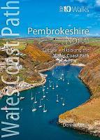
Featured walks include: Newport Bay, Dinas Island, Goodwick & Carregwastad, Strumble Head, Abercastle & Aberdraw, Porthgain & Abereiddy, St David`s Head, Porth Clais & Whitesands Bay, St David`s & St Non`s, Solva.

Kartenbeispiel

Pembrokeshire North - Top 10 Walks Series Circular Walks along the Wales Coast Path - Dennis Kelsall - Mara Books
EAN / ISBN: 9781908632296
Preis: EUR 14.90

Bestellartikel: versandfertig in ca. 1-3 Wochen. Dieser Artikel wird speziell für Sie bestellt. Keine Rücknahme!
Produkt EUR Anzahl Bestellen
Pembrokeshire North - Top 10 Walks Series Circular Walks along the Wales Coast Path - Dennis Kelsall - Mara Books 14.90
Versandkostenfrei in Deutschland ab 20,- Bestellwert

incl. MwSt.

Stichworte, die bei der Suche nützlich sein könnten:
Pembrokeshire South Wanderführer - Pembrokeshire South - Pembrokeshire - Großbritannien - Großbritannien Wanderführer - Großbritannien Trekkingführer - Großbritannien Klettern - Großbritannien Kletterführer

Zuletzt angesehene Artikel:

CoverPembrokeshire North - Top 10 Walks Series Circular Walks along the Wales Coast Path - Dennis Kelsall - Mara Books

Cover808-1 ALMADÉN Amtliche topographische Landkarte 1:25.000 Spanien (M.T.N.)
808-1 Mapa Topográfico Nacional de Espana (MTN25) Instituto Geográfico Nacional - CNIG Spanien

CoverGorges du Verdon - Topographische Wanderkarte Frankreich 1:16.500 Besondere Orte in Frankreich entdecken
Gorges du Verdon - DECOUVERTE DES LIEUX D`EXCEPTION IGN Frankreich

CoverZakopane Stadtplan 1:15.000
Zakopane plan miasta EkoGraf - Polen

CoverPesaro - Urbino Stadtplan 1:8.000/1:6.500
Pesaro - Urbino - Pianta della Citta L.A.C. GlobalMap Italien

CoverKronobergs län Terräng CD (3) Topographische Landkarte Schweden 1:50.000 auf CD-ROM Kartförlaget Schweden

CoverPeak District Nord - Wanderkarte 1:40.000 (wasser- und reißfest) Ultramap XT40
Peak District North - hiking map (durable, tear-resistent and 100% waterproof) HARVEY MAPS - Großbritannien

CoverKulturSchock Irland / Nordirland KulturSchock Reise-Know-How Verlag

CoverVal d`Aran Pyrenées by UTMB Trail running race map 1:40.000 Wanderkarte Spanien - ALPINA

CoverKönigreiche Sachsen und Westphalen 1808 - Historische Landkarte Nachdruck Planokarte - gerollt von Mollo, Tranquillo - Verlag Rockstuhl

CoverKantonesisch AusspracheTrainer (Audio-CD) Kauderwelsch AusspracheTrainer auf CD Reise-Know-How Verlag

CoverAlgarve MM-Wandern Wanderführer mit GPS-kartierten Wanderungen - von Cornelia Hempel - Michael-Müller-Verlag

CoverPyrenäen Reiseführer Reise-Know-How Verlag

CoverKyrgyztan Guide Reiseführer (englisch) Bradt Publications

CoverLas Feixas - trekking Pyrenées - 154km - 9 etapas - Monte Perdido - La Munia - Posets Wanderkarte Spanien - ALPINA

Cover974-1 VÉLEZ- RUBIO Amtliche topographische Landkarte 1:25.000 Spanien (M.T.N.)
974-1 Mapa Topográfico Nacional de Espana (MTN25) Instituto Geográfico Nacional - CNIG Spanien

Cover2123 10 Lastustenkulma Topographische Karte 1:20.000 (Maastokartta / Peruskartta / Grundkarta) Maanmittauslaitos / Lantmäteriverket Finnland - ProjektNord

Cover3941 Rädigke Sonderausgabe mit Wanderwegen - Topographische Wanderkarte Brandenburg 1:25.000 ProjektNord

Cover2114-II-NØ Topographische Karte Dänemark 1:25.000
Topografisk kort Danmark (DTK/Kort25) 2114-II-NØ ProjektNord - Kort & Matrikelstyrelsen / Geodætisk Institut

Cover838-1 SANTA CRUZ DE MUDELA Amtliche topographische Landkarte 1:25.000 Spanien (M.T.N.)
838-1 Mapa Topográfico Nacional de Espana (MTN25) Instituto Geográfico Nacional - CNIG Spanien