Willkommen bei MapFox
Wurde Ihre Bestellung bestätigt? Wenn nicht - gab es evtl. ein SERVER-Problem! Bitte kontaktieren Sie uns! +++ Buchhändler-Anfragen erwünscht +++
Warenkorb
Artikel: 0 - € 0.00
Zur Kasse
Widerruf Impressum Kontakt Versandkosten AGB
West Highland Way Wanderatlas Spiralo 1:100.000 (wasserfest) Rucksack Readers
<< Schottland
 
Cover

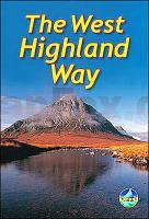
The West Highland Way is the first and most famous of Scotland`s long-distance walks. It stretches for 95 miles (152 km) of superb scenery, from the outskirts of Glasgow, Scotland`s largest city, through its first National Park, along the shores of its largest loch, ending in Fort William, at the foot of Ben Nevis, Britain`s highest mountain.

This 2011 edition of our popular guidebook was fully revised in late 2010. It describes the West Highland Way in detail from Milngavie northward, including the final "extra mile" in Fort William. It has many fresh photographs and many updates, and contains all you need to plan and enjoy your holiday on the West Highland Way:

  • the Way in sections, with summaries of distance, terrain and where to find food and drink
  • concise background on the history and wildlife
  • information about side-trips, e.g. Ben Lomond and Ben Nevis
  • background information about Loch Lomond, history, habitats and wildlife
  • planning information for travel by car, train, bus or plane
  • drop-down route map of the West Highland Way in six panels (1:100,000)
  • in full colour, with 70 photographs
  • on waterproof paper throughout.

Kartenausschnitt

Kartenbeispiel

West Highland Way Wanderatlas Spiralo 1:100.000 (wasserfest) Rucksack Readers
EAN / ISBN: 9781913817213
Preis: EUR 24.90

Bestellartikel: versandfertig in ca. 3-7 Tagen. Dieser Artikel wird speziell für Sie bestellt. Keine Rücknahme!
Produkt EUR Anzahl Bestellen
West Highland Way Wanderatlas Spiralo 1:100.000 (wasserfest) Rucksack Readers 24.90
Versandkostenfrei in Deutschland ab 30,- Bestellwert

incl. MwSt.

Stichworte, die bei der Suche nützlich sein könnten:
West Highland Way - Schottland - Schottland Landkartenverkauf - Schottland Atlanten - Schottland Kartographie - Schottland Wanderkarten - Schottland Radwanderkarten - Schottland Kartografie - Schottland Fahrradkarten - Schottland Reiseführer - Schottland Radwanderführer - Schottlandkarten - Schottland Landkarten - Schottland Karten - Schottland Straßenkarten

Zuletzt angesehene Artikel:

CoverWest Highland Way Wanderatlas Spiralo 1:100.000 (wasserfest) Rucksack Readers

CoverU4131 Väylänpää Topographische Karte 1:25.000 EUREF (Peruskartta) Maanmittauslaitos / Lantmäteriverket Finnland - ProjektNord

Noch kein Cover vorhandenBed & Breakfast Atlas Großbritannien (aktuelle Jahresausgabe)
Bed & Breakfast Britain AA - Automobile Association

CoverJotunheimen: Tyin & Filefjell 1:25.000 Høyfjellskart - Gebirgswanderkarte Norwegen - Calazo Förlag

Cover3227 Eschede Amtliche topographische Karte 1:25.000 Landesvermessungsamt Niedersachsen

CoverTellin Wanderkarte NGI 1:20.000 Au Pays de Lesse et de la Lhomme - Commune de Telllin - Bure - Grupont - Resteigne - Tellin - Touristische Landkarte und Wanderkarte Belgien NGI Belgien

Cover106L14 Tidigeh Lake Topographische Landkarte 1:50.000 - Canada - Yukon Territory

CoverLemmenjoki Wanderkarte 1:25.000 / 1:100.000 - Finnland - Calazo Förlag

CoverJakobsweg von der Rhön an die Donau - von Simon, Martin - Stein, Conrad, Verlag

CoverP4132 Soini Topographische Karte 1:25.000 EUREF (Peruskartta) Maanmittauslaitos / Lantmäteriverket Finnland - ProjektNord

CoverS5213 Kouva Topographische Karte 1:25.000 EUREF (Peruskartta) Maanmittauslaitos / Lantmäteriverket Finnland - ProjektNord

CoverCC 4702 Düsseldorf Topographische Übersichtskarte 1:200.000 - Bundesamt für Kartografie und Geodäsie und Landesvermessungsämter - ProjektNord

CoverNarvik 1:50.000 Wanderkarte - Turkart Norwegen - Calazo Förlag

Cover10142 Harstad Topographische Landkarte 1:50.000 Norge-serien - Nordeca Norwegen

CoverRegion Primorje 1:200.000 / 1:500.000 Topographischer-Straßenatlas Russland
Primorskij Kraj - Atlas awtodorog Dal`newostochnyj Federal`nyj Okrug - Russland

CoverCAMINANT PER L´ALBIOL - Muntanyes de Prades Sud Wanderkarte 1:15.000 - Editorial Piolet - Spanien

CoverL5516 Wetzlar (geplottete Ausgabe) Topographische Landkarte Hessen 1:50.000 - ProjektNord

Cover105M11 Williamson Lake - Yukon Territory Topographische Landkarte 1:50.000 - Canada - Yukon

Cover106K05 Topographische Landkarte 1:50.000 - Canada - Yukon North West Territories

CoverL3113 Husö Topographische Karte 1:25.000 EUREF (Peruskartta) Maanmittauslaitos / Lantmäteriverket Finnland - ProjektNord