Willkommen bei MapFox
+++ Buchhändleranfragen willkommen! Tel. 0431-666 75 99 +++
Warenkorb
Artikel: 0 - € 0.00
Zur Kasse
Impressum Kontakt Versandkosten AGB
Lisbon - Walk & Eat Sunflower-Wanderführer - englisch
<< Portugal: Reiseführer, Wanderführer und Radwanderführer
<< Sunflower-Wanderführer
 
Cover

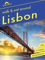
This pocket-sized full-colour guide is designed for short-break walking holidays in Lisbon and around the capital using the excellent public transport network. Even ?non-walkers’ will appreciate the large-scale city plans and maps, descriptions of the sights, and recommendations for restaurants in Lisbon and other tourist centres like Sintra and Cascais. For each suggested restaurant there is a photograph of the décor and one of their dishes, sample menu, price guide, opening times, and a recipe for one of their specialities. Other sections include: planning your trip, logistics on arrival, local markets and specialities, glossary of local food terms, and a restaurant mini-vocabulary. A special feature is the emphasis on natural local foods suitable for those with food intolerances. All recipes have been made by the authors and are known to ?work’.

Area covered: The book describes one walk in the city centre, five in the Sintra-Cascais Natural Park and other walks further afield but easily reached by public transport. There are two excursions - one to the Tagus Estuary Natural Park, the other to the medieval walled town of Óbidos.

The best months for walking in Lisbon and around are April-June and September/October, although it is usually mild enough to walk in this area right through the winter months. Only in July and August would it be far too hot - but one can still enjoy the restaurants in Lisbon and the other popular centres covered!

Lisbon - Walk & Eat Sunflower-Wanderführer - englisch
EAN / ISBN: 9781856915663
Preis: EUR 16.90

Bestellartikel: versandfertig in ca. 3-7 Tagen. Dieser Artikel wird speziell für Sie bestellt. Keine Rücknahme!
Produkt EUR Anzahl Bestellen
Lisbon - Walk & Eat Sunflower-Wanderführer - englisch 16.90
Versandkostenfrei in Deutschland ab 20,- Bestellwert

incl. MwSt.

Stichworte, die bei der Suche nützlich sein könnten:
Lissabon Reiseführer - Portugal Wanderführer - Portugal Reiseführer - Portugal Wanderführer - Portugal Fahrradführer - Portugal Radführer - Portugal Radwanderführer - Portugal MTB-Führer - Portugal Mountainbike - Sunflower (Reiseführer)

Zuletzt angesehene Artikel:

CoverLisbon - Walk & Eat Sunflower-Wanderführer - englisch

CoverRund um Osnabrück - Osnabrücker und Tecklenburger Land - 50 Touren - Rother Wanderführer - Bergverlag Rother

CoverProvence, zwischen Ardéche und Verdonschlucht (Nr. 5944) Wanderführer mit Extra-Tourenkarte, 55 Touren, GPX-Daten zum Download. - von Astrid Sturm KOMPASS-Karten

CoverGebrauchsanweisung für Japan - von Andreas Neuenkirchen - Piper Verlag

Cover1132 05 KYLMÄ-PIHLAVA Topographische Karte 1:20.000 (Maastokartta / Peruskartta / Grundkarta) Maanmittauslaitos / Lantmäteriverket Finnland - ProjektNord

Cover254 Lleyn Peninsula East / Pen Llyn Ardal Ddwreiniol - Wanderkarte Großbritannien 1:25.000 EXPLORER MAP - Active Map LAMINIERT - Ordnance Survey

CoverKattowitz und Umgebung Stadtatlas 1:20.000 Stadtatlas / Stadtpläne
Katowice Okręg plus 26 atlas Demart - Polen

Cover1178 GROSS LITZNER 1:25.000 - Partenen - Bielerhöhe - Galtür - Topographische Landeskarte der Schweiz - swisstopo

CoverSüdnorwegen Reiseführer Reise-Know-How Verlag

CoverOL7 English Lakes - South Eastern area active in. - laminierte Wanderkarte Großbritannien 1:25.000 EXPLORER MAP - Ordnance Survey

Cover890-2 LAS MINAS Amtliche topographische Landkarte 1:25.000 Spanien (M.T.N.)
890-2 Mapa Topográfico Nacional de Espana (MTN25) Instituto Geográfico Nacional - CNIG Spanien

CoverQ431 Pyhäjärvi Topographische Karte 1:50.000 EUREF-FIN (Maastokarttat) Maanmittauslaitos / Lantmäteriverket Finnland - ProjektNord

Cover265-2 SABUGUIDO Amtliche topographische Landkarte 1:25.000 Spanien (M.T.N.)
265-2 Mapa Topográfico Nacional de Espana (MTN25) Instituto Geográfico Nacional - CNIG Spanien

CoverFerrara Provinzialautokarte - Straßenkarte 1:150.000 - Italien
Ferrara - Carta stradale della Provincia - Italia L.A.C. GlobalMap Italien

CoverBükk Atlas 1:40.000 Wanderatlas Ungarn (ungarisch) - Cartographia

CoverCastrop-Rauxel Süd 1944 1:19.000 (Blatt 13) Alte Stadtpläne des Ruhrgebiets
Old maps of the Ruhr Alan Godfrey Maps

Cover461 Orkney - East Mainland - Wanderkarte Großbritannien 1:25.000 ORKNEY - East Mainland - South Ronaldsay - Shapinsay - Kirkwall - EXPLORER MAP - Ordnance Survey

CoverPiemont - Aostatal Straßenkarte Local 1:200.000 (Blatt 351) Michelin Italien

CoverBöhmische Schweiz - Böhmisches Mittelgebirge - Rother Wanderführer - Bergverlag Rother

Cover24-23 Protivanov Topographische Karte 1:50.000 der Tschechischen Republik
Zakladní mapa Ceská republika - Cesky urad zememericky a katastralni - ProjektNord