Willkommen bei MapFox
+++ Buchhändleranfragen willkommen! Tel. 0431-666 75 99 +++
Warenkorb
Artikel: 0 - € 0.00
Zur Kasse
Impressum Kontakt Versandkosten AGB
Lake District: High Level and Fell Walks Wanderführer (englisch) Cicerone Großbritannien
<< Großbritannien: Wanderführer + Kletterführer
<< Cicerone
 
Cover

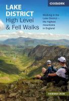
This guidebook collects the best 30 high fell walks in the Lake District. Every route is graded for difficulty and ranges between 7-23km, and includes annotated OS maps and variant routes. The walks are divided into 6 sections according to where walkers can start: the Keswick area, Borrowdale and Buttermere, the Western Valleys, Coniston and Langdale, Ambleside, Grasmere and Windermere, or Ullswater.

The walks combine Lakeland classics with lesser-known adventures. From classic horseshoes, such as the Newlands Round and the Fairfield Horseshoe, and traditional ascents of England`s most iconic mountains, including its highest peaks Scafell Pike, Scafell, Helvellyn and Skiddaw, to routes onto some of the quieter summits including Gray Crag and Beda Fell, or quieter routes onto popular fells including Blencathra and Red Screes, the walks in this guide comprise all the best high-level fell walks to be had in England`s largest, and beloved National Park.

Covering both rocky terrain and grassy hills, with occasional boggy ground, most of the paths are relatively easy-to-follow in clear conditions, but may require good navigational skills when the clouds roll in. The guidebook also includes information to enhance your walking, from historical, geological and wildlife detail, to advice on travelling to and around the Lake District, and how to best prepare for an excellent day out on the fells.

Kartenausschnitt

Lake District: High Level and Fell Walks Wanderführer (englisch) Cicerone Großbritannien
EAN / ISBN: 9781786312266
Preis: EUR 19.90

Bestellartikel: versandfertig in ca. 3-7 Tagen. Dieser Artikel wird speziell für Sie bestellt. Keine Rücknahme!
Produkt EUR Anzahl Bestellen
Lake District: High Level and Fell Walks Wanderführer (englisch) Cicerone Großbritannien 19.90
Versandkostenfrei in Deutschland ab 30,- Bestellwert

incl. MwSt.

Stichworte, die bei der Suche nützlich sein könnten:
Lake District - Cicerone - Cicerone Radwanderführer - Cicerone Wanderführer - Großbritannien Radwanderführer - Großbritannien Wanderführer - Cicerone Großbritannien - Großbritannien - Großbritannien Wanderführer - Großbritannien Trekkingführer - Großbritannien Klettern - Großbritannien Kletterführer

Zuletzt angesehene Artikel:

CoverLake District: High Level and Fell Walks Wanderführer (englisch) Cicerone Großbritannien

CoverDurham (Slow Travel) City, Dales & Coast - von Hall, Gemma - Bradt Guides

Cover5 Havelland Regionalkarte 1:100.000 Landesvermessung und Geobasisinformation Brandenburg

CoverNordseeküste Niedersachsens Reiseführer Reise-Know-How Verlag

CoverMallorca / Majorca 1:160.000 Straßenkarte Berndtson

Noch kein Cover vorhandenModesto / Ceres / Turlock / Oakdale Stadtplan 1:28.000 (Kalifornien - USA)
Modesto / Ceres / Turlock / Oakdale street map American Automobile Association

CoverKenia Landkarte (Blatt 3205) AdventureMap wasserfest
Kenya National Geographic

CoverGuatemala - Belize Landkarte (Blatt 3110) AdventureMap wasserfest
Guatemala, Belize National Geographic

CoverPeriple a peu pel Montsant Literatura Munanya - Editorial Piolet - Spanien

CoverConnemara & Mayo: Mountain, Coastal & Island Walks Wanderführer - Paul Phelan - Collins Press

CoverKosovo Travel Guide Reiseführer (englisch) Bradt Publications

CoverNational Trails of the United States - Destination Touring Map aund Guide National Geographic

Cover50 Walks in West-Yorkshire Wanderführer - AA Automobile Association / OS Ordnance Survey - Großbritannien

CoverAppennino e Riviera Genovese - Appennino Ligure - Topographische Wanderkarte 1:25.000 (Blatt 3-4) Carta dei Sentieri e Rifugi - Edizioni Multigraphic - Italien

CoverCycling Guide Danube Bike Trail 1 1:50.000 - bikeline Esterbauer

CoverFrankfurt 1977 (Blatt 154) Historischer Bildstadtplan Bollmann-Bildkarten-Verlag

CoverThames Path, in the Country - From the source to Hampton Court National Trail Guide - by David Sharp & Tony Gowers - Aurum Press Ltd

CoverWhisky Map of Scotland Bartholomew / Collins
Scotland´s Distilleries

CoverDuMont direkt Kanalinseln, Jersey, Guernsey, Alderney, Sark

Cover159 Reading - Wokingham & Pangbourne - Wanderkarte Großbritannien 1:25.000 EXPLORER MAP - Active Map LAMINIERT - Ordnance Survey