 The European Alps offer some of the finest and most accessible ski mountaineering in the world. A combination of magnificent and varied terrain, an enviable snow record, excellent public transport, unrivalled hut system and a long ski season make them a focus for mountaineering and skiers throughout the world. This guidebook includes some of the finest ski tours of the central and eastern Alps - hut-to-hut trails that explore the Bernese, Urner, Albula and Bernina Alps of Switzerland, as well as classic tours through the Silvretta, Otztal, Stubai and Ortler regions of Austria and Italy. None of the routes is extreme, although the conditions can be, and it’s for that reason that mountaineering judgement and sound decisions are all important. The 11 tours in this guidebook cover a significant part of the Northern as well as the Central and Eastern Alps. They range across Alpine Switzerland from its north-west corner to its south-east tip, from Vaud to Graubunden, before sliding east, following the vast arc of the Alps into the Austrian Tyrol and South Tyrol of north Italy. All the tours described in this guidebook are in areas that bristle with 3000m peaks, glaciers and extensive permanent snowfields. The Central and Eastern Alps also have an enviable snow record, and in many instances can offer ski touring when other areas are waiting for better snow cover to fill crevasses and make travel on dangerous glaciers possible. The selection in this guidebook covers tours in the most important Alpine regions. They are also varied in length and difficulty, although most fit within a full week’s touring. Of course, if poor weather or conditions prevail they can take a lot longer. The routes also include a mix of circular tours, which are convenient for those wishing to leave car or equipment in one place, and linear routes that journey hut to hut or even from country to country. The routes described are all Alpine - they require both skiing and mountaineering skills. While technical climbing ability of a high standard is not essential, the skills required to operate on steep slopes and glacial terrain, where cramponing, ropework and crevasse rescue may be necessary, are essential for safety, as are navigational skills. It goes without saying that avalanche awareness skills and knowledge are vitally important for everyone who intends to ski mountaineer.  Kartenausschnitt Kartenausschnitt
Kartenbeispiel
|
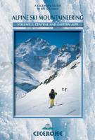
Alpine Ski Mountaineering Volume 2: Central and Eastern Alps Alps - cross border routes (englisch) - Cicerone
EAN / ISBN: 9781852843748
Preis: EUR 22.90
|
| 


